Leg 3: Port
Hardy to Rattenbury Island Hakai Pass
|
Date |
|
Weather |
|
|
July 10/06 |
|
Port Hardy to Clam Cove, |
Sunny and windy with cloudy periods by evening |
Click on Pictures to Enlarge
|
Pulteney Point Light Station at Northwest end of
Entrance to Clam Cove looking out to
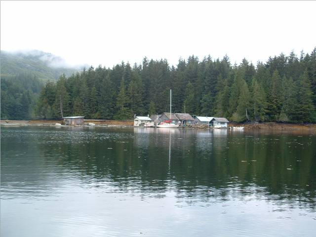
Float Camp at Clam Cove
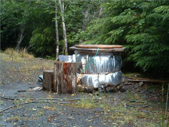
HotTub at Clam Cove Camp
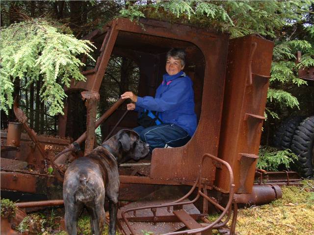
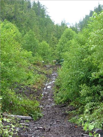
Old LoggingTractor In Clam Cove Forest Trail
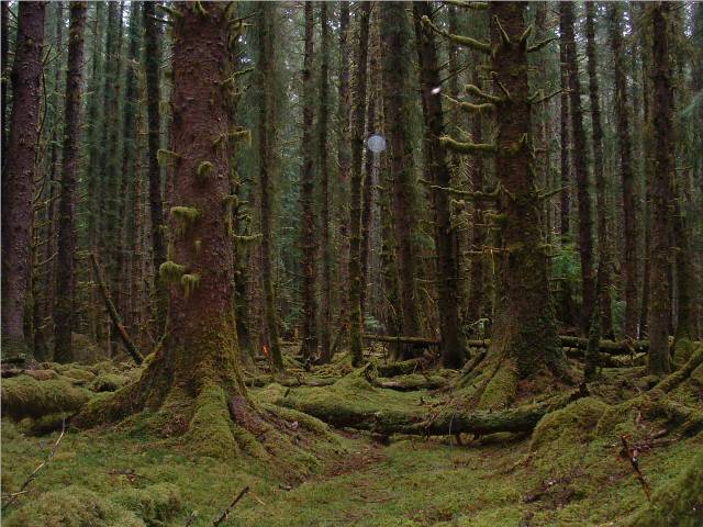
Old Growth Forest Trail to Port
Alexander |
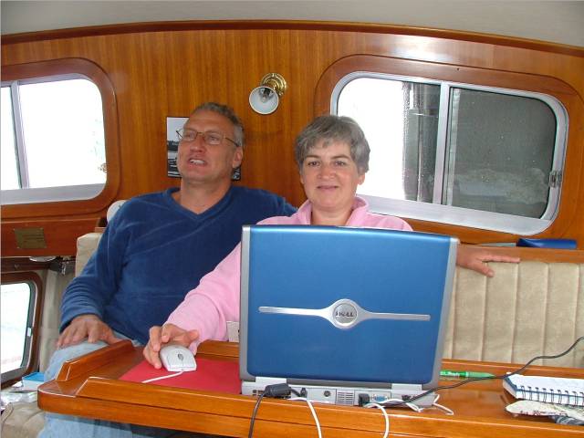
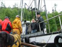
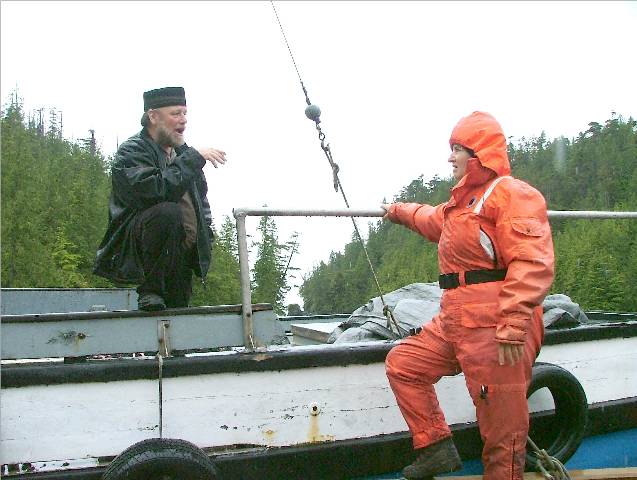
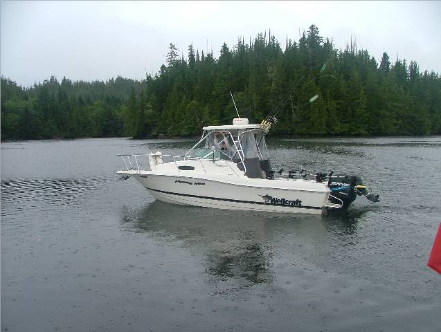
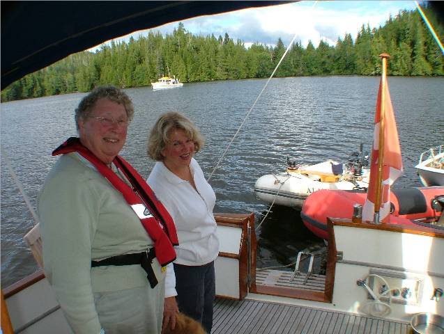
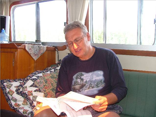
We spent most of today lounging about reading, chatting with some fishermen on the dock and doing minor chores; teak oiling the cap rails, purchasing fishing tackle from the Quarterdeck Marina store, and filling the RIB gas tanks at the Esso station. The wind was blowing strong and not predicted to lessen until late afternoon. When Rick was out in the Catch-Up getting gas he again met
up with Alison and Don from the Saltire.
They were being towed in by another sailboat rafted to them because
their engine had quit with a loud “cluck”.
Rick towed their dingy in for them and the other sailboat turned them
loose at the Quarterdeck Marina docks.
The situation was bad; their trip around Back at our dock the Desiree, the Saltire’s traveling
companions, had tied up near us and were disappointed that the trip had to be
held up by mechanical problems on the Saltire. It appeared they would need to
replace the engine which could take up to a week to repair. In my opinion, they couldn’t be in a better
place to have engine trouble. It could
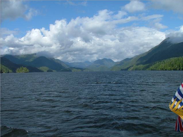
have happened on the west coast of At 1600 we decided to leave and head for The water had about a four foot chop from Port Hardy to
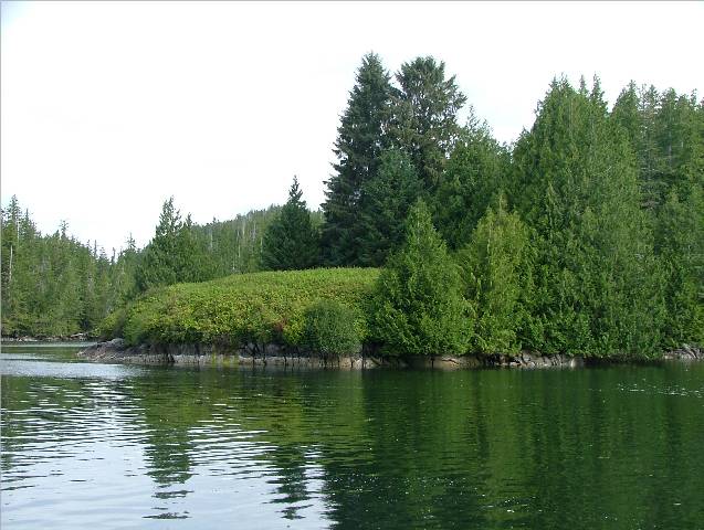
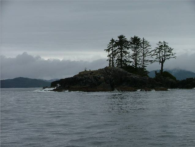
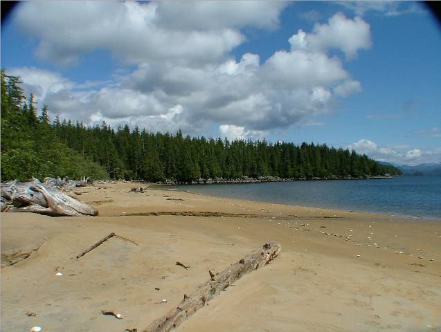
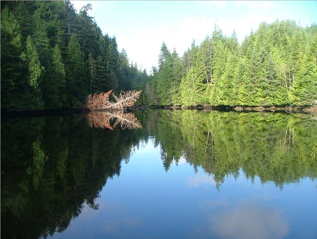
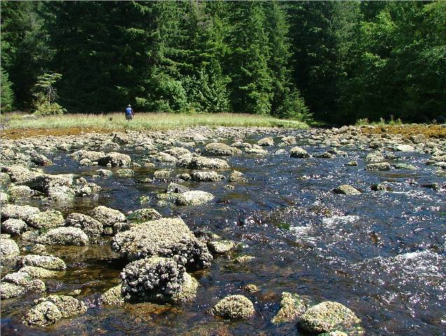
Browning Passage but once in the passage the water was smooth. We like to anchor in a long narrow bay on
the east side of Nigei just south of Hougestal Point. It isn’t named on the
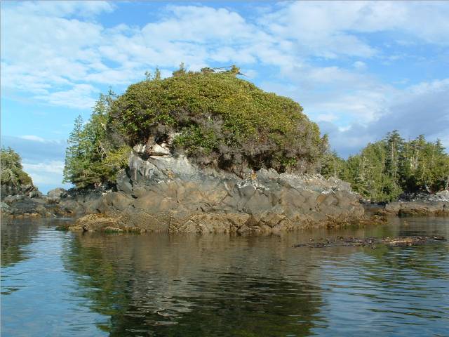
chart but there is a sign as you enter in saying “Clam Cove”. On the chart it looks tricky to get into
but it is easily navigable and the most offending rocks are marked, one with
a yellow soccer ball and the other with a red float with several logs tied to
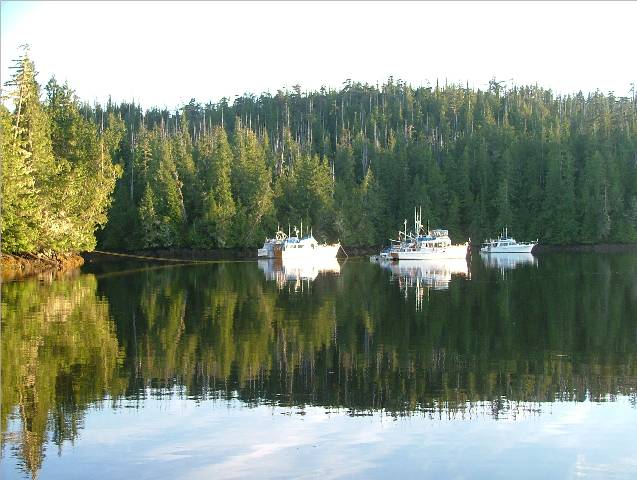
it. There are two rudimentary camps
here, one a series of floating shacks and the other a dock with a collection
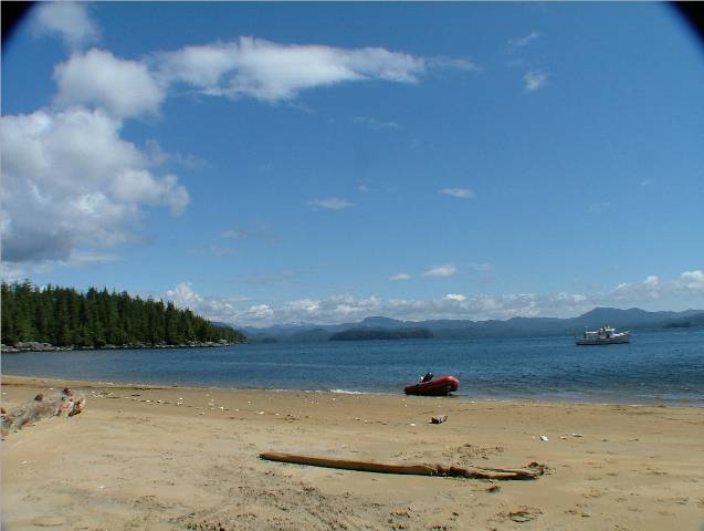
of two tents with a shelter and outhouse just up the ramp. Two separate families arrive in their small
aluminum runabouts and enjoy this area from these summer camps. The children
were out kayaking in the small coves off the bay when we first came in and
later several adults headed out in a small skiff to fish after supper. The camp on land has their own private
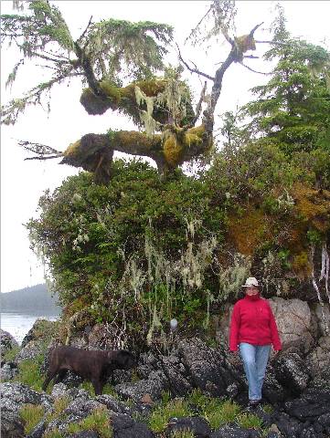
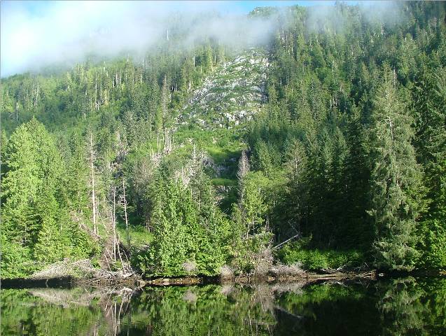
outdoor hot tub heated by a propane tank under the tub. There is a trail that leads from their camp
through a canopy forest to the other side of the island at Port
Alexander. It’s a nice easy hike to
the other side where often large boats are anchored waiting to cross over to Once we were anchored Kona went to shore to explore, we
had supper and read for the rest of the evening. The weather report had changed some and we
decided to stay in this anchorage until perhaps Wednesday morning. The weather forecast was calling for gales
in |

|
Date |
|
Weather |
|
|
July 11/06 |
|
Clam Cove, |
Cloudy with periods of rain |
Click on
Pictures to Enlarge
|
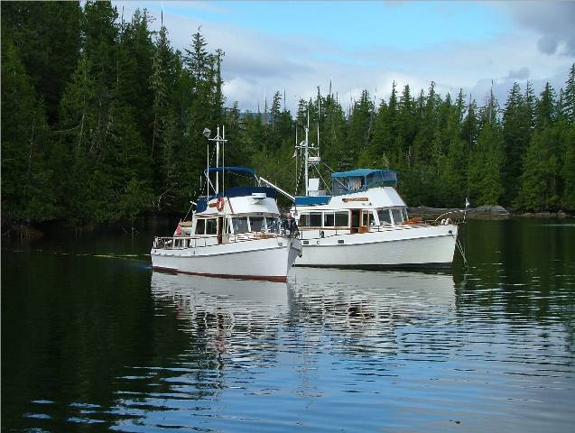
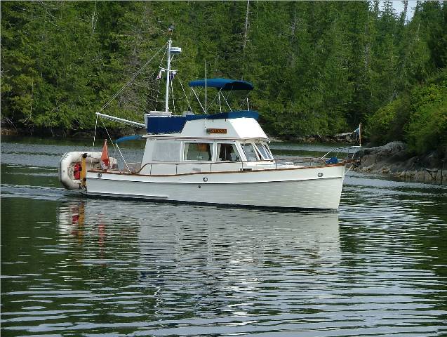
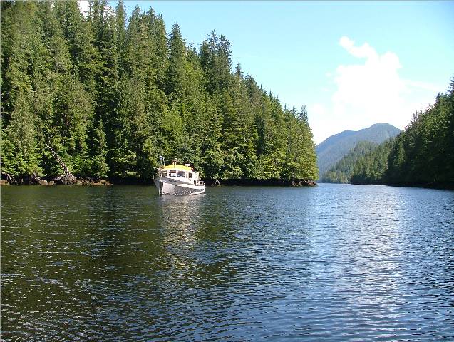
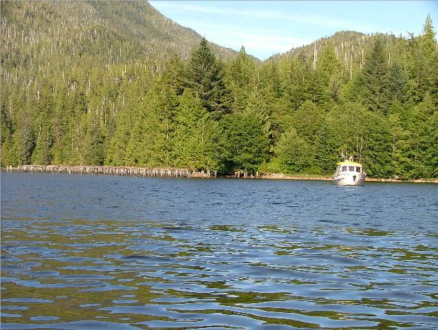
SV Moha Motoring In to Our
Interesting Rock Formations at Entrance to Clam Cove |
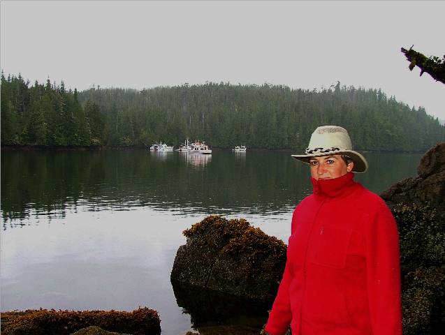
Rick got up at 0700 and checked the weather report but didn’t like what it had to say so we slept in. That’s the nice thing about having two months off. If you don’t feel like moving, you don’t. We decided today would be another lazy day of reading, exploring and later if it doesn’t rain too hard, our first attempt at fishing. We have a map, given to us by our friend and fishing
expert, After breakfast, which I’m almost embarrassed to say, was
at 1100, we waved to and welcomed another sailing vessel into our anchorage,
the SV Moha. Later in the day around
1400, another sailing vessel, the SV Potato Caboose, from Rick later spoke to the Captain of the Moha and he and the
Potatoe Caboose were headed around We decided at 1500 to try our luck at fishing. Slack was at 1600 so we got all our gear
organized and headed for the east side of Once we got inside we turn on the espar heater to warm up. As we were munching on our dinner, a large, perhaps eighty-five foot Nordhaven, the MV Amazing Grace, motored into our anchorage. The boat was lovely and the bow on it was huge. We retired early in case we had to make an early morning
break for |

|
Date |
|
Weather |
|
|
July 12/06 |
|
Clam Cove, |
Cloudy with periods of light rain |
Click on
Pictures to Enlarge
|
Calgarian Kayakers in Clam Cove
All Decked out for the Rain
Anticipation of
We at our table in the Pilot
House while Sea Foam’s Autopilot guides us to our destination
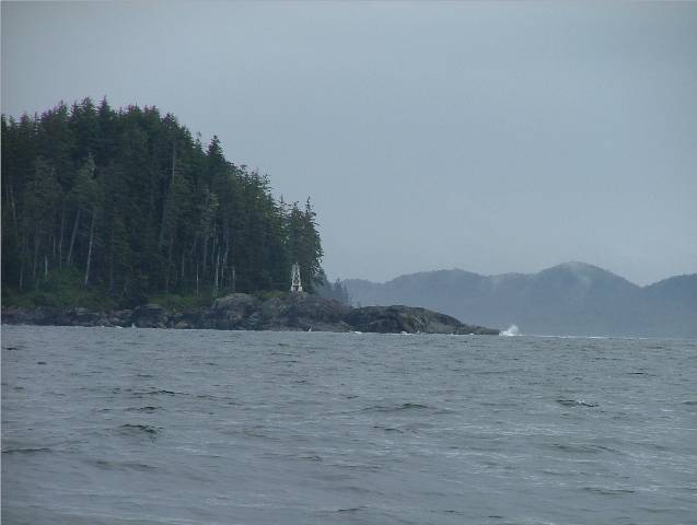
Approaching
Past
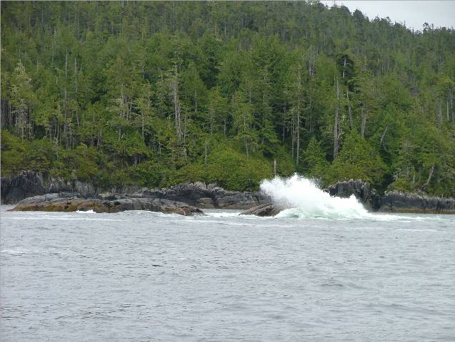
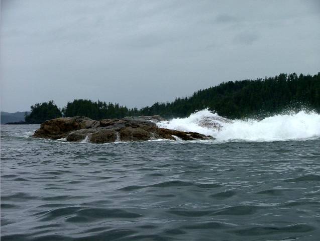
Surf at
The Treacherous Conditions are
shown by the wind and salt battered trees
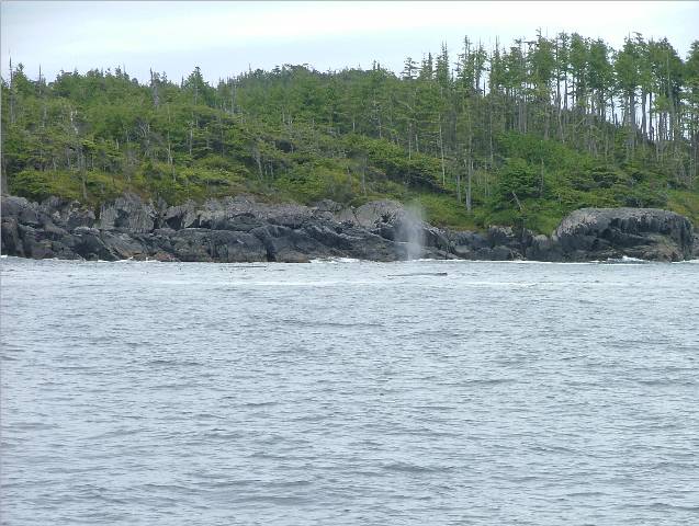
Whales here too!
Decorative Tree in
CA at Kona Watering Hole with Sea
Foam in background in
Limited area for Kona’s shore
leave
Some rocky beach for Kona at low
tide |
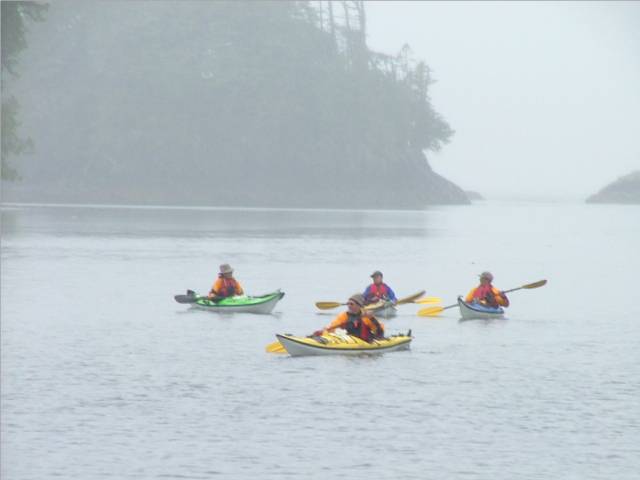
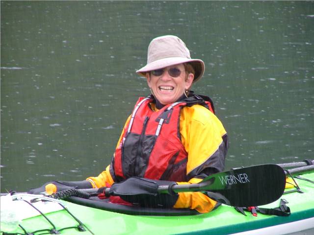
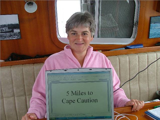
I woke up at 0630 and listened to the weather report. I was more interested to know what the weather buoys had to say about wind speed and swell height than what the weather predictions were. The wind blew up over night and the rain poured down on us. Even in our protected anchorage our chain road rattled around all night. There were definitely gales out there and I was glad to be snug in my bed. At West Sea Otter the wind was from the south at 18 knots and the sea swell height along with the wave that might be on top of it was at 1.8 metres. In a sidebar piece in the Wagonneer a woman was told by a tug boat driver that he crosses Queen Charlotte Sound only when the West Sea Otter buoy was .9 metres or less or he might have his log booms break up. She decided that whenever she crossed she would adopt the same plan and only go if the swell height was 1.5 metres of less. I think that is a good plan so I when back to bed and if the weather predictions were accurate, the winds were going to ease by late morning. We slept and read until 1100 and listened to the 1030 weather report. The wind at Pine Island had increased from 10 to 20 knots and at Egg Island 12 to 18 in a five hour period. Nothing about this information encouraged me to make the crossing. The Captain said things would improve after breakfast but I could feel myself becoming tense. My first trip around Cape Caution was going to be a positive one or I was afraid I might not want to make it more than once. After breakfast some kayakers from Once again my expert eavesdropping abilities have worked in our favour. A boater on the radio was hailing a trawler in Richards Channel which is on the mainland side just north of our location. He asked the trawler heading southward what the conditions at Cape Caution were like. The Captain answered that they weren’t too bad at all and he thought the wind was lessening. The Captain in Richards Channel commented that it was a little rough around the islands he was traveling in but you could almost hear relief in his voice that the upcoming water was going to improve. For me that was first-hand, up-to-the-minute information that I needed and when Rick returned I said, “Tie up the rib, we’re headin’ out!” He wanted it to be my idea in case their was any regret later. As we got out into Queen Charlotte Strait we were pleasantly
surprised to find the water very nice.
Maybe a one foot chop. As we
passed Next we passed Storm Islands at their northern tip and the
swells began to increase. They
reminded me of the water in Hawaii as it moves into shore before it
breaks. It also brought back memories
from when I was twelve years old and I was onboard a P&O ocean liner, the
Orianna, on a one month cruise from As we neared When we were almost directly across from Cape Caution and
out from in about one and a half miles the sea began to change. We were in sixty feet of water now and the
reflection of the incoming swells up onto the shallow shelf and into the
shore line made the boat sway side to side more than it had throughout the
whole trip. Once we passed the The first noticeable difference to me was the surf pounding on the shore line. The water was certainly not bad, perhaps a two metre swell, but the water when it hit the rocks rose up with a mighty white spray. The outlying rocks as we entered in continued to spray up white water as well. The trees along the coastline are quite sparse where their branches have been so exposed to the salt spray that they are swept back and spindly. We thought we would go into Jones Cove as it was the first anchorage in the Sound that we had read was a good one. When we saw the opening and the rocks and spray surrounding it we thought that the swells must surely get into the cove and it would be an uncomfortable place, despite what the guide books had suggested. We decided to continue on up the Sound into Takush Habour where many small nooks to anchor came off from the main basin. We anchored in Fly Basin at the east end. When we came through the narrow opening we
were surprised to see six other boats anchored there as well. One of the
boats, the MV Once we were anchored we took Kona to shore but found it difficult to find a place. The area is all rock with thick undergrowth right to the edge of the water. We finally spotted what looked like a small area to take her off. As we approached the narrow beach the water was suddenly alive with what looked like rat tails and as we beached the boat I noticed large holes in the mud around the rocks. They looked like clam holes but bigger. I later was told there are large worms that are found along the muddy shore lines and I wondered if these worms are what I saw scurrying for shelter down into their holes when we approached. On our return we talked to the Captain of the Once we settled down for the night the wind picked up and we were hearing the tell-tale lap of small waves up against our hull. This was a good all weather anchorage so we slept soundly. |


|
Date |
|
Weather |
|
|
July 13/06 |
|
|
Cloudy,rainy, 13 celcius |
Click on Pictures to Enlarge
|
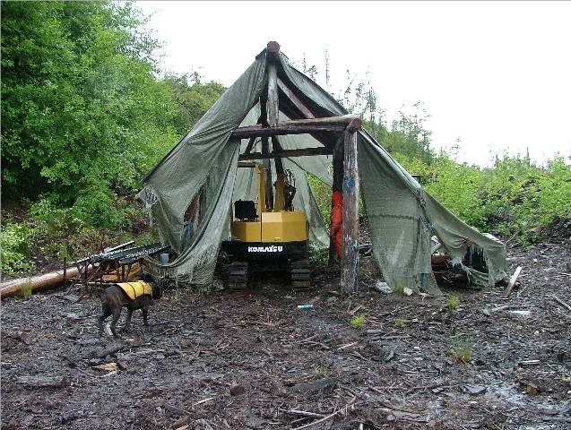
Path Leading to Dr. Iron’s
proposed Cabin Site
Tractor for Future Work on the
Iron Acreage
Bill and Linda Irons
Dock Talk on the Iron’s Dock and Dylan and Bob from the
Westville
Bob and son Dylan onboard the
Westville
CA Listening to Bob’s Stories
Surf on Leroy Rock just outside |
Today we set out to find and visit Dr. When we pulled up to his dock we knew we had the right place, even though there was no boat in sight, because he had his boat name painted on the new dock he had barged in last year. There were also several coolers on the dock with his last name clearly marked on them. We got out and started up the muddy path, hoping to perhaps find someone at home up on the hill. As we climbed we were impressed with the view he had overlooking Smith Sound. We reached the top of the first of several clearings and found his small backhoe under its shelter but no sign of any one else around. We followed a path still further up and again took in the breathtaking views. When we returned down the path and were almost at the dock we could hear people talking and sure enough, Bill and Linda were back from a successful fishing trip in their twenty-six Wellcraft. His two Irish Setters were anxious to make Kona’s acquaintance. We greeted them and had many stories to share. Not long after a fishing packer boat, the “Westville” came into Bill’s dock to deliver hydraulic fuel for him to fix his leaking backhoe. They were coming to the dock to wait for the “King Clam” to deliver her load of sea urchins to be taken back to Port Hardy. On board the Westville were Bob and his son, Dylan. Rick had met the Captain of the King Clam in Port Hardy the day we departed there. Bill told us many local stories about the area, including the “beach that can eat you” and the case of the disappearing Chinese fish cannery workers from the early 1900’s. He went on to tell us that if you eat a soup bowl full of sea urchin eggs everyday you will be healthy, robust and have the strength and energy of a giant. We stayed and chatted until 1600 and decided rather than wear out our welcome we would return to our own boat. Before leaving Bill generously bestowed upon us a 10 pound Coho and a small ling cod for supper. All we could think of to give him in return was some dry socks the next time we visited. |
|
Date |
|
Weather |
|
|
July 14/06 |
|
|
Cloudy,rainy, 13 C |
Click on Pictures to Enlarge
|
Bill and Linda Irons on the Sea
Foam
Morning Mist Departs
Fellow Mariners at anchor in Left to Right: |
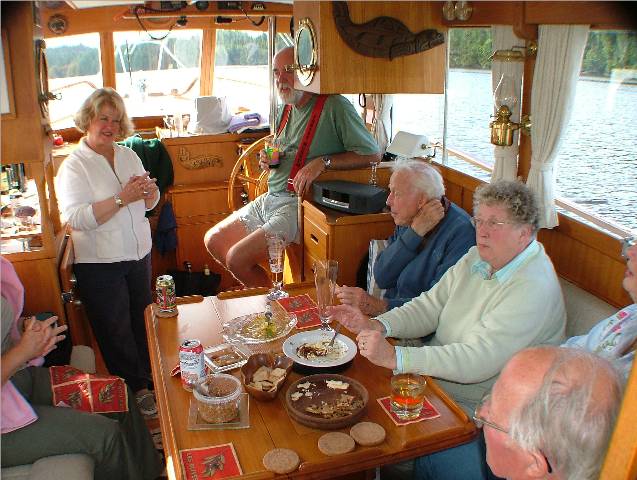
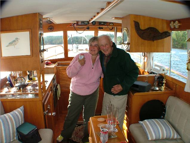
We slept in late because it was raining so hard. We were no sooner up and had a cup of coffee then Bill and Linda arrived for a visit. We spent from noon until 1400 visiting with them in the pilot house and sharing stories. Bill is quite a fisherman and has fished all over Vancouver Island and the Queen Charlotte’s. He and Linda circumnavigated Vancouver Island in their 26 footer. Quite impressive I think! After they had been gone only about half an hour Bill
called on the radio to tell us he had caught a 30 pound halibut in the
location he and Rick had picked out on our charts just outside of We decided to go give it a try and loaded up our fishing
gear into the Catch-Up. As we pulled
away Captain Warren and his friend Al from the MV We headed to the location that Bill had suggested and dropped our gear. Before long we were snagged or so we thought. It was going to be a rod breaker to continue to try to break free so Rick wound the line around our fish bonker and reeled the line in manually. He soon felt the tension give and soon we had all our gear back attached to a strange large white piece of flesh complete with an air bladder. We couldn’t determine what matter of fish this might be so we are saying that we had a very large halibut on our hook and rather than come up off the bottom he gave up part of his cheek to us instead. We decided to try to fish for salmon and while we did
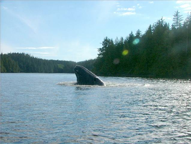
three humpback whales moved into our area.
They were now along the shore line around the northern end of After we caught one more fish we decided to head for
home. As we came into our basin,
Captain Warren, from MV We returned to the Sea Foam as the whale made his way out into Browning Channel. He had been feeding in our area for over two hours. In the distance the two other whales were making their way further north toward Smith Inlet. |
|
Date |
|
Weather |
|
|
July 15/06 |
|
|
Cloudy with sunny periods in the afternoon |
Click on Pictures to Enlarge
|
Surf Off Leroy Rock
Happy Hour Gang onboard the Alana
CA and Alec the Octogenarian
Departing the Alana with Sea Foam in the Background
Humpback Whale Head Up At Entrance to
MV rafted with MV Majestra in
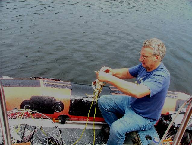
Stubborn Crab Clinging to a Rope |
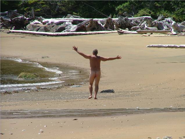
Northwesterlies are in the forecast now so although we woke up to a cloudy day we had high hopes for improved weather conditions. After breakfast we decided to try a dive, my first surf dive to be more accurate. Rick wanted to have me experience the feel of the water pushing and pulling at you under the water as the surf comes in and out against rocks and reefs above you. With the surf comes oxygen and food so the idea is the life would be abundant in these types of locations. The same theory that fishermen use to locate a good fishing spot. I admit to being tentative after seeing the waves break
against rocks and shorelines around here. Today was a good day to try this
out because the winds were calm and the swells were minimal. We took the Catch-Up to the outside of On our return the whales were back again in the channel
leisurely swimming along and coming out of the water with a mouth full every
so often. While listening to two pleasure boaters talking about their adventures on the VHF, one man said that a humpback had come right into his anchorage and lay right beside his boat as if sleeping. He took photos of it so people would believe him. He said the blowhole was about a foot across. The man he was speaking to told the story of how friends of his had actually run into a sleeping whale and it raised the bow of their boat four feet into the air. The whale surfaced and came up behind them and gave a mighty roar through its blowhole as if it were some mad about the whole thing. By the time we returned from diving, put away our gear and
had a shower, it was time for Happy Hour.
The venue had changed to another We met We spent a pleasant two hours telling stories of boating adventures and it was helpful to listen to experienced cruisers telling us things to look out for in the areas we plan to visit this summer. They were also happy to give us the locations of their favorite anchorages and successful fishing holes. Two stories about Carolyn had been told to be very cautious of the wolves that live on the island. There are no bears on the island only wolves. Carolyn cautioned us that when we walk on the beach we should keep Kona on a leash. She had said she was told that one wolf will come to the beach and lure your dog away and once that is accomplished the pack comes down from the dunes and attacks and kills your dog. She said she wouldn’t have believed it if she hadn’t seen it with her own two eyes. She and Warren were on the beach with their little Schnauzer and gave this warning to a woman with a German Shepherd. The woman did not heed her warning and sure enough, the lone wolf appeared and luckily, after repeated commands to come, the shepherd returned to her master and didn’t go to visit the wolf. Carolyn said she and Warren both saw the wolves waiting up in the dunes overlooking the beach. Now that the sun had decided to appear we got to talking
about why this anchorage is called This prompted After our stories were done we exchanged boat cards and
hopes that we would meet again. We
picked up Kona from the boat and headed to her shore spot across from the
opening to our anchorage. We again saw
the humpback whale making his way in our direction, right into our
anchorage. We had the camera and Rick
was able to get some better shots today.
The sun was out and we followed the whale out of the anchorage and
into We left the whale to his feeding and came back to our
anchorage. The SV Cat’s Paw had come
in earlier and we stopped to talk with them in their dinghy. The Captain was less than impressed with
the whale coming into the anchorage and when he told us how he had been “held
hostage” by the Orca, Luna, in Gold River, we could better understand his distrust
of the large mammals. Luna had damaged
his boat to the tune of fifteen thousand dollars and his experience with the
political arena surrounding the whale’s presence in So many stories to tell and to be told! We finally made it back to our own boat, had a late supper and retired. |
|
Date |
|
Weather |
|
|
July 16/06 |
|
|
Sunny with cloudy periods |
Click on Pictures to Enlarge
|
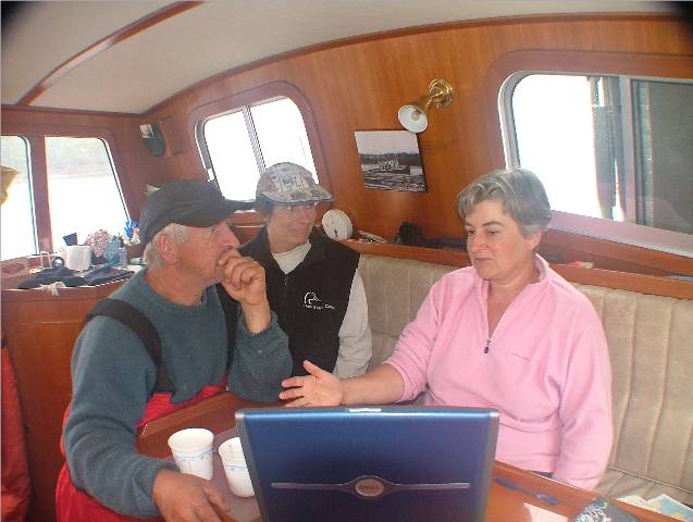
Captain Studying the Cummings Manual
Thinking, Thinking!!
Narrow west entrance to Broad
Reach in Ahclakerho Channel
View once Through the Narrows on
the way to Broad Reach
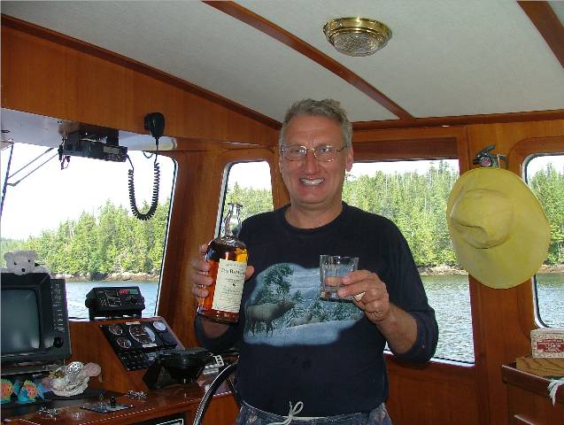
A Toast To Success! My Husband Can Fix Anything |
Such a pleasant surprise to see the sunshine after so many days of rain and cloudy weather. The Grand Banks vessels left the anchorage this morning as did two large American boats from Seattle. Yesterday there were thirteen boats anchored in here. I thought this was considered a remote area! We have seen more boats up here then we did during our brief trip through the Broughtons to get to Port Hardy. Captain Bonar from the Alana came by to bid us farewell
and said they were off to Fury Island off Penrose Island at River’s Inlet to
see how the fishing might be around there.
We planned on kayaking today and even moving on to another location ourselves. Rick decided to fill the scuba tanks before stowing them away. When he started the compressor he didn’t realize that the air intake hose, earlier positioned over the side of the boat, had slipped down and was now in the water. The result was salt water came in through the hose and the compressor was out of commission. Salt water inside the compressor was a death sentence to be sure. I thought it would be a good time to take Kona to shore and left the area with Rick muttering and working on the compressor. I took Kona to shore, picked up our crab trap and returned to the Sea Foam to be told that diving for the summer had come to an end. The salt water had done its damage and the compressor would need a major overhaul. We decided that we would move to a different location so we prepared to move out. We stowed away all our scuba gear and dealt with that disappointment reasonably well. Rick then went to start the engine but to no avail. The engine would turn over but would not start. Trouble shooting began. This day had gone from bad to worse as far as equipment goes. Rick determined that the fuel shut off valve was the problem. Of course, to make matters worse, the switch was located where no hands or tools will easily fit. After much time and effort he succeeded and took it out and apart and found that the valve worked fine but the electrical solenoid that opens and closes the valve was not working. It looked just like a short fat spark plug to me. One little two inch part rendered us dead in the water. He took it out and if the engine would start we would have to stop the engine by turning the fuel switches off. It appeared that this should work. Well, it didn’t. He tried bleeding the lines, thinking that air could be a factor now. That didn’t help either. I prayed while Rick went back and forth from the engine room to the engine manual. Rick remembered a conversation last summer with the Captain of the Nordic Tug MVSonship, where his fuel injector pump packed it in. We began talking about what if the engine wouldn’t start. Do we have insurance for the tow into Port Hardy? Yes! Well, that’s good news. As a backdrop to this we are hearing people on the radio talking about all the whales they are seeing outside in Browning Channel. One man said he had his dinghy engine off and was bringing in his lines and one whale came within five feet of his boat. He said he could almost reach out and touch him. Rick continued to assess the situation and determined that we need a new fuel injector pump. We placed a call to Prince Rupert Coast Guard asking for commercial assistance to tow us into Port Hardy. Not long after giving our coordinates we received a call from the tugboat, Gulf Prince, heading northward with a barge in tow. On his return in one or two days he offered to pick us up as he heads southward and tow us into Port Hardy. From there we will get a mechanic and the parts we need and all will be well in no time! It’s been one of those days; a terrible, horrible, no good very bad day, but it will make a good story and we’ll laugh about it someday soon. Our trip to Hakai will just have to wait – and so will the wolves and the white spotted flies. Captain Rick says the only positive thing about today is that we will end up saving fuel! We decided to go out fishing to soothe our minds. Rick had been stressed by the whole day’s events and a relaxing putt out on the water would help. We loaded up the fishing gear and took off in the Catch-Up. More whales were spotted as we left Takush Harbour. Using our binoculars I saw the great humpback tail come out of the water with their unique-to-each-whale white markings on the underside. After we fished a while with no luck we decided to explore Ahclakerho Channel approaching from the west side. There is a narrow neck that you have to go through that dries at six feet. There is another easier way to get in but you have to go sixteen miles north and east around the top of Greaves Island to get in with a bigger boat. The narrows can only be traveled at high slack turning to an ebb - that way if you hit a rock at least you will be pushed back away from it rather than pushed into still more of the same. The time was right for us to go and have a look so we headed over to the entrance. As we approached, the couple from the SV Cat’s Paw were rowing out of the neck in their dinghy with their motor up. They told us the water was running at about seven knots and to watch out for a large rock on the right hand side as you go through. He added to keep to the centre and we should be fine. We had talked about coming through here in the kayaks but after seeing how fast the water moved it would have to have been timed carefully. Cautiously, (after what had already happened today we did not need any more incidents), we started in. There was some tension as the sounder alarm went off at five feet but we made it through to the other side and had a quick look around. As we came to the area where the water empties into a basin where you can go either north or south, we spotted a mooring buoy in the middle of the basin. We had a look at that and then thought we had better get back out of here again while the going was still good. I would like to go into this area from the eastern side with the Sea Foam on another occasion. We made it safely back out again and the water had picked up speed considerably even in that short time. As we came back into our anchorage again we pulled off at
Kona’s island and let her on land for a stretch and a pee. As we were leaving a couple from the MV
Hull’s We started dinner and within about twenty minutes a man I had met earlier while pulling our crab trap up approached the Sea Foam with another older white hair fellow. They had decided to come tonight to lend a hand and we welcomed them both on board. Bob (Gina) was from the Nordic Tug MV Lori Lee, and Bruce (Lois) was from the MV Hideaway. Warren and Carolyn had pointed them out the day before. He knew them as members of their yacht club and stated they were a very nice couple to know. About now I was in complete agreement with that! Rick went over with them the trouble shooting he had done thus far and Bruce went into the engine compartment and started poking around with Bob overseeing from under the stairs in the salon. Bruce opened a nut that Rick hadn’t tried as a way to bleed the air out of the lines and was successful as the spot started frothing and diesel came out. Rick turned the key and pushed the start button and the engine turned over. We were back in business! What a sweet sound to hear the Cummings back humming once again. Rick had correctly diagnosed the problem to be the shut off valve solenoid but hadn’t found the correct nut that bled the air off efficiently. We thanked the two men and they left us after being on board for only about twenty minutes. After a day like today, being left with only a compressor with seized up rings from salt water seemed pale in comparison to what could have been the outcome if we needed towing to Port Hardy and a fuel injector pump installed. Rick called the Prince Rupert Coast Guard to cancel the Gulf Prince assistant. The Gulf Prince was monitoring the call first from channel 16 and then from channel 83A as we talked further with the Coast Guard. They came over the radio and said they were pleased to hear we were back up and running and wished us well for the rest of our holiday. Rick thanked the Captain of the Gulf Prince as well as the Prince Rupert Coast Guard for their assistance throughout this dilemma. We had a quick dinner at 2130 and retired after a very trying and emotionally exhausting day. |

Click on Pictures to Enlarge
|
Date |
|
Weather |
|
|
July 17/06 |
|
Fly Basin, Takush Harbour to Boswell Cove, Boswell Inlet |
Sunny and warm with a few clouds |
|
Dsulish Bay, Smith Sound
Sea Foam and Catch-Up at
It Doesn’t Get Any Better Than
This
Kona and the Captain Enjoying
Some Much Needed Play Time
Boswell Inlet looking North |
We woke up to find that our helpful mechanic friends had left as well as the two sailing vessels, Cat’s Paw and Erasmus. After breakfast Rick went to the Hull’s Hull and thanked Captain Kirk for sending us Bob and Bruce to assist us last night. He restated what I had told Rick yesterday. When you need help, ask the boaters around you if they can be of any assistance. It proved to be true for us yesterday. We had breakfast and pulled up our anchor and headed just a short distance across Smith Sound to the north side and over to the beautiful sandy beach at Dsulish Bay. Kona needed a good run and some wide open space and after yesterday, Rick and I needed a picnic on the beach with some cool beverages and a chance to unwind. We arrived and had the beach to ourselves. The wind was blowing smartly from the west but the sun was shining warm and the water sparkling so we enjoyed several hours of stick throwing with Kona and relaxation sitting in the sand. We headed north up Blackney Channel into Boswell Inlet
bound for an anchorage that As we passed Denison Island a whale spout caught our attention. He crossed our bow and came up looking like he was jumping out to catch a bird that had flown close to the surface. He was smaller than what we had recently seen so we guessed he was a minke whale. He continued on down the channel and we continued on our way northward. We found Boswell Cove, and anchored. The sun was in the cove and it was warm, quiet, and very secluded. A lovely anchorage! We set out to lay a prawn trap for the first time this trip. As we motored out an Orca dorsal fin caught my eye. We stopped the engine and waited to hear or see more whales. All we saw was the one lone whale, which in itself seem unusual to me. The whale moved slowly back and forth across the narrow waterway and when it showed its dorsal fin it appeared to me to be the very sharp pointed kind that indicates a transient whale. After about fifteen minutes he moved south past us and we laid our trap in a drop off at about two hundred and fifty feet. We took Kona to shore, had dinner and talked over plans for tomorrows adventures. Lights out at 2030.
|
|
|
|
Click on Pictures to Enlarge
|
Date |
|
Weather |
|
|
July 18/06 |
|
Boswell Cove to Margaret Bay, Smith Inlet |
Sunny with a few clouds |
|
Boswell Cove
Morning in Boswell Cove
Looking North Out the Entrance to
Boswell Cove
Water Like a Mirror in Boswell
Cove
Boswell Cove
Stream Running into Boswell Inlet Looks Like Bear Country to Me!
Margaret Bay
Swimming in the Warm Water
“I’m Not Leavin’! I Like It
Here!” |
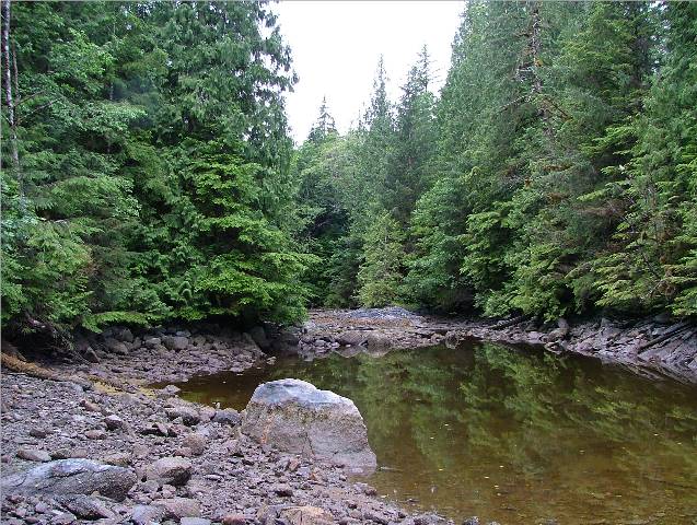
Another thing that makes this anchor spot so nice is that you not only have sunshine in the late evening but also first thing in the morning! With the steep sided terrain around the inlet we didn’t expect to have the sun warming us. What a treat! The only sounds are birds chirping in the trees and little fish flipping on the surface of the water. After we took some pictures and Kona to shore we went to retrieve our prawn trap. We managed to catch two cod greenlings and zero prawns. The fish would make a nice meal for tonight’s supper. We explored the area outside our anchorage and took some pictures of a creek bed across from the opening to the anchorage. We later checked the chart and a small lake is at the head of this unnamed creek. At the top of Boswell Inlet it is approximately two miles as the crow flies, over land to Draney Inlet, found to the east of River’s Inlet. Rick fussed further with the compressor after I pointed out that oil was running all over the teak in the stern cockpit. He was somewhat happier when he started it again and found that it did move into the three thousand pound compression area but it took ten minutes to get there. Normally it would get to the amount in ten seconds. Updated verdict on the compressor – not as bad as he first thought, maybe the pistons were okay but the rings were probably not. We still couldn’t fill up scuba tanks but the damage was not as extensive as first thought. We headed off south down Boswell Inlet and the wind was whipping up some steep three foot waves as the northwest winds, around here more west than north, made their afternoon sweep through the area. We decided not to go too far and pulled into Margaret Bay, just as you turn into Smith Inlet on the north side. We passed Ethel Cove on the way and noted it also had a
really nice beach for Kona but open to the wind at the moment. As we entered Margaret Bay there is a float
on the north side in a small bay as well as a large log secured to the
shoreline. Once we were anchored we decided to go around the corner to the beach in Ethel Cove and it was a rough ride in the Catch-Up as we rounded the corner to get there. It was luckily only a short distance to be going bow first into the waves and then we tacked back into Ethel Cove and surfed the waves into the beach. We spent the remainder of the day at the beach, Kona swimming and us sitting and sipping red wine on the sand. Very nice sunny day and much enjoyed by all us! When we ordered Kona to get into the Catch-Up she stubbornly sat on the beach and wouldn’t budge. I had to speak rather firmly to her before she got her stubborn Mastiff self into the tender. She loves the beach! When we returned to the Sea Foam we had a closer look at the floating camp on the north side of the bay. There are three good sized trailers there as well as an older tug and a metal skiff – they even have a satellite dish! There didn’t appear to be anyone at home or if there was they didn’t come out to say hello. We enjoyed a meal of fresh cod, watched a DVD and retired.
|

|
Date |
|
Weather |
|
|
July 19/06 |
|
|
Cloudy with a few sunny periods |
Click on Pictures to Enlarge
|
Who Manicures theHedges in
Majestra and in
Alana In |
After breakfast we decided that the weather forecast was good for a long travel today. We planned a six hour trip to Pruth Bay on Calvert Island traveling north in Fitz Hugh Sound. As we left Margaret Bay and traveled southward in Blackney Channel along the north side of Smith Sound the wind was light and the water just a ripple. When we came around Kelp Head into Irving Passage heading north the water was flat calm. As we passed River’s Inlet there was a weather update warning of gales coming from the southeast this afternoon. It was 1300 and we had four more hours to go. We then heard We made contact with Alec from Majestra and relayed to
Warren from We had a gorgeous cruise up Fitz Hugh Sound with the water
barely a ripple. We were the last to
arrive at the anchorage and there were four other boats in the basin as
well. Lucky Lady rafted with Sky Bird
– both from We returned to the Sea Foam, had dinner, shore duty for Kona and retired. |