Leg 5: Shearwater to Port Hardy
|
|
|
Weather |
|
|
July 30/06 |
|
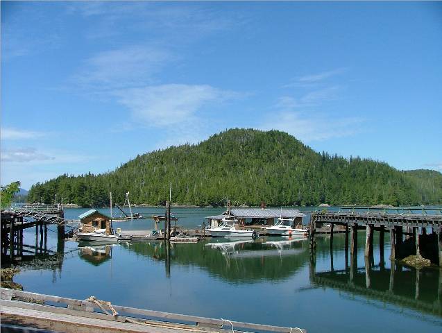
Shearwater Docks, Denny Island to Lizzie Cove, Hunter Island |
Cloudy with Rainy Periods |
Click on
Pictures to Enlarge
|
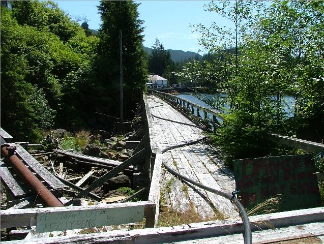
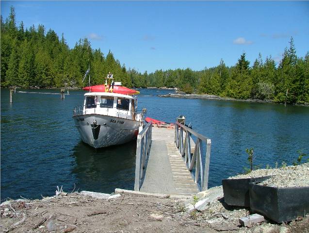
Radiant Star Entering
Shearwater Taking Our Spot on the Dock As We Depart
New Bella Bella Docks
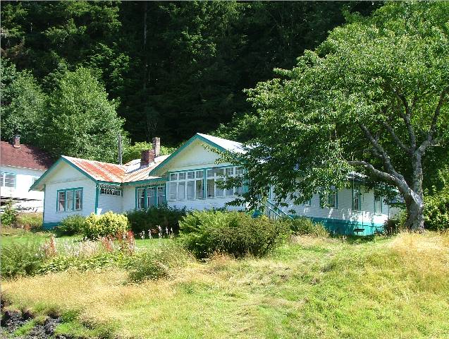
New Bella Bella Ocean Front Homes
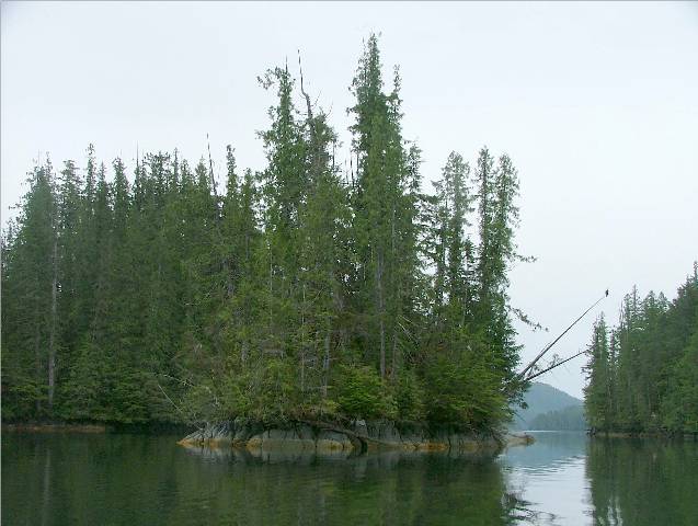
Lizzie Bay, Hunter Island |
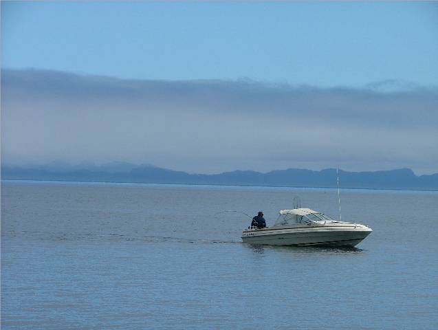
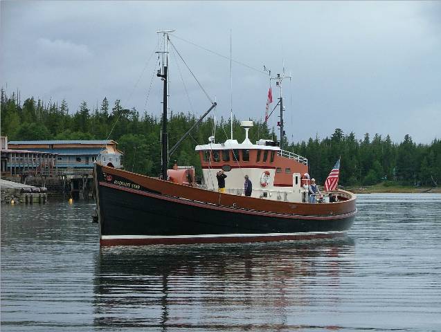
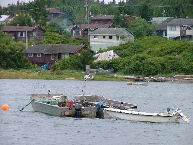
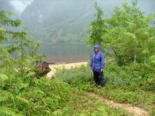
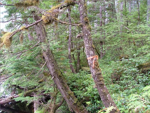
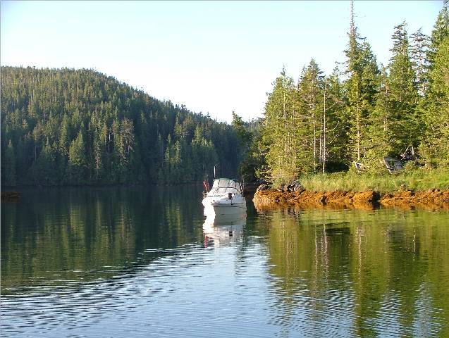
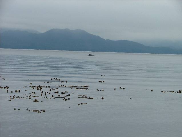
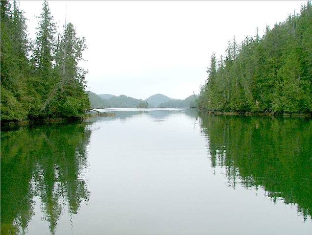
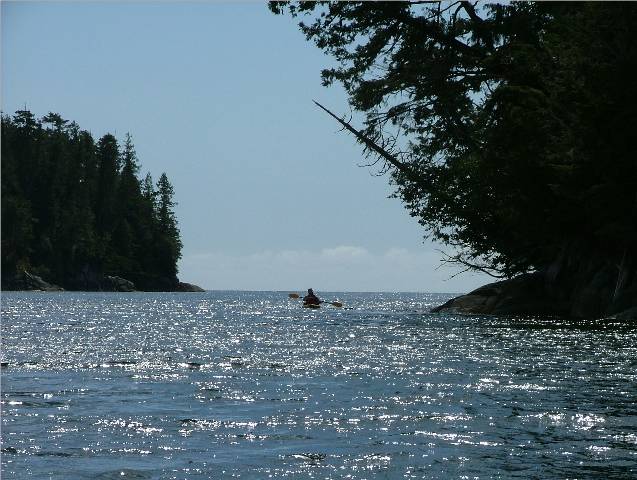
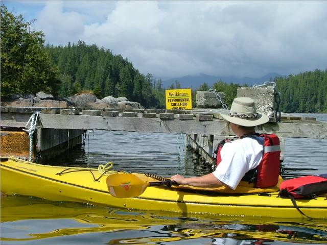
We woke up to another drizzling day. Now that we knew we had cell phone reception we decided to update the web site for posting and send out some personal e-mail. We left the dock after noon and anchored off of New Bella Bella. We went in the Catch-Up to the docks there so CA could go into the grocery store. The docks looked fine to us and we realized that we could also have docked there. We’ll keep that in mind for next year. Water was also available at the docks and looked to be clearer than the water we took on in Shearwater. By about 1600 we had everything done that we wanted to do and we weighed anchored and headed to Lizzie Cove, a spot off Cooper Inlet on the north end of Hunter Island in Lama Passage. The Douglass’ said that this was a very sheltered anchorage but poorly charted with an uneven bottom. The rocks are dangerous in the entrance but with electronic charts and two locally made markers floating on the worst of the rocks it was not difficult to negotiate the entrance. Two other boats were anchored in the centre of the bay close to the head. We chose a small “pond” just off the east side of the main bay. It was a tricky bit to get in there but we had a great view out to Lama Passage and the winds were calm. All the rocks on our electronic charts were showing where they should be.
|

|
Date |
|
Weather |
|
|
July 31/06 |
|
Lizzie Cove, Hunter Island to Codville Lagoon, Codville Marine Park, King Island |
Cloudy with Rainy Periods |
Click on
Pictures to Enlarge
|
Lizzie Cove Castoff
One Lizzie Cove Resident
Another Lizzie Cove Resident
MV Parry in Lama Passage
MV Our Realm with MV Pacific Story in the Background |
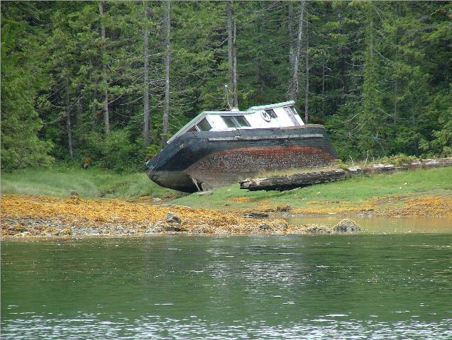
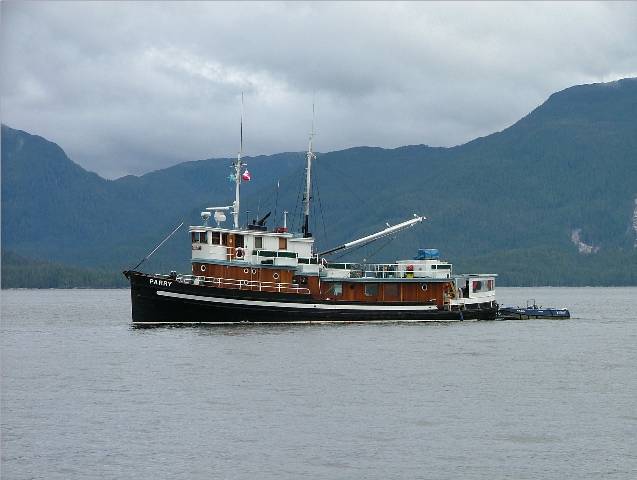
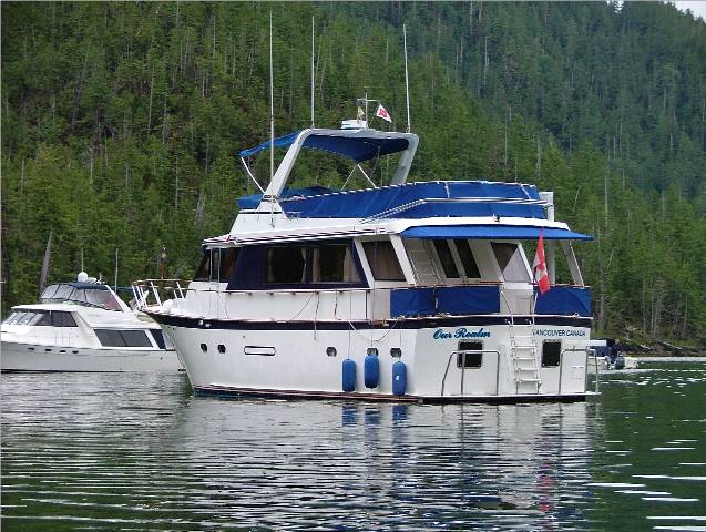
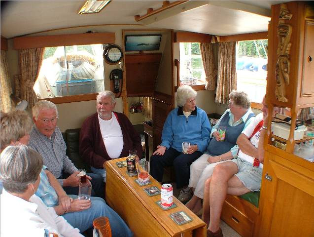
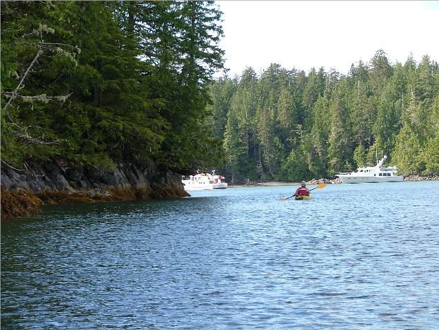
We took pictures of the two homes that are situation in this cove. One appears to have a small farm on it and the other only a small home. There is also a boat house sheltering an old boat and several smaller boats strewn along the shoreline. After Rick and Kona thoroughly combed the area we packed up and headed out for Codville Lagoon. We carefully picked our way out of our anchor spot and through the exit route of rocks and into Lama Passage. The water was smooth and we had a leisurely cruise. Several boats were transiting the passage as well. Two old wooden boats, the MV UnionJack and the MV Parry were particularly noteworthy. They are both charter boats that take their passengers into fishing areas, off load them in smaller skiffs and puddle about waiting for them to return or meet at another nearby location. By the time we entered Codville Bay Anderson Cove had called us on the radio to find out our whereabouts. They had met with some friends in the lagoon onboard the MV Our Realm. We were invited to their vessel for Happy Hour. As soon as we got into Codville Lagoon and anchored near the trail to Sagar Lake, we gathered up our appetizer and beverages and made our way to Our Realm. We met the Captain, Bob, and his wife, Maureen. Their vessel is a fifty five footer from Hong Kong. The previous owners, an airplane pilot and his wife, had lived aboard the boat in Hong Kong rather than live in a hotel as they were in and out of Hong Kong on a regular basis. Bob and Maureen intend to have this boat taken to Mexico by barge and leave it there for two or three years. They will go to the boat in the winter to cruise in a warmer climate. They have secured moorage in La Paz by the year and were quite pleased to discover that they are only deducted for the months that their vessel is tied up to the dock. When they are on the boat and cruising around, the months are on hold which is not typically the way moorage around these parts works! We also met Rita and Alan from the MV Pacific Story. They had just bought their 47 Bayliner Pilot house and already Alan is looking for something else. They also have a 34 foot Ponderosa but they have an offer on it and are hopeful the sale will complete. They had met with Ann and Ed from Idle Hours in Ocean Falls and we were happy to hear they were well and on their way to Williams Lake for their planned visit to meet with their new grand daughter. Rita and Alan, and Bob and Maureen had spent the day hiking to Sagar Lake. Rita said the lake was gorgeous and well worth the hike. We asked if it was as muddy as everyone says and Rita said that Maureen had worn her running shoes and didn’t have much trouble. After visiting and enjoying a wide array of appetizers from smoked salmon to spinach quiche, we said our thank-you’s and farewells and returned to the Sea Foam. There was no need to make supper because we were so full from Happy Hour. Instead, we gathered up our prawn gear and headed out to the entrance of the anchorage to put our traps down. Alec and Kay had already dropped their traps earlier and said this was reported to be a good location for prawns. On our return we stopped and talked to the sail boaters next to us on the SV Kir Royale. They were just returning from the Queen Charlottes. They said they had an easy crossing of Hecate Strait on the way over but not so easy on the return trip. They said they wouldn’t go again in a sailboat the size of theirs. Their boat looked to be about thirty feet long. We asked them what they had to do to land on the islands and they said you can go into either Sandspit or Queen Charlotte City and register. Then you must take a one hour orientation course and pay a one time fee to visit the areas on the islands with notice given to the Haida Watchmen before entering. We returned to the Sea Foam and retired.
|


|
Date |
|
Weather |
|
|
August 1/06 |
|
Codville Lagoon, Codville Marine Park, King Island |
Cloudy and rainy with moments of sunshine |
Click on
Pictures to Enlarge
|
Come and Look At This!
Sagar Lake, Codville Lagoon Beautiful Even in the Rain
Sagar Lake Picnic Site
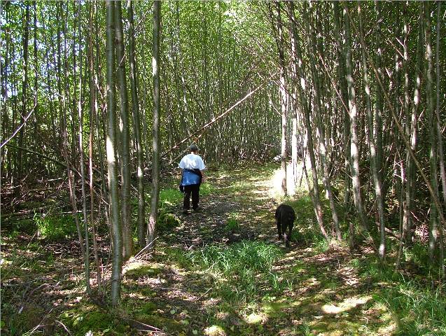
Picking Through the Roots
Watchful for “Ankle Busters”
Trail Made Easy Going Down!
Back to the Waiting “Catch-Up” from
Great Way to End a Hike Dinner on the Anderson Cove! |
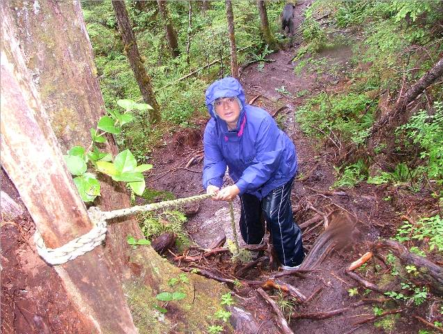
It’s raining again! After breakfast and shore duty with Kona we took off in the Catch-Up and collected our prawn traps. We had sixty in one trap and about ten in the other. We also found an Irish Lord fish in this trap with prawn “feelers” sticking out of his mouth! When we later cut him up for crab bait we found three whole prawns in his stomach sack – thief! We re-baited the traps and put them down again. When we got back to the boat we got ready to head off to the Sagar Lake Trail. The tide was coming in so securing the Catch-Up wasn’t going to be a problem. We started the hike and had to be very careful of our footing. The trail is clear and well marked but muddy in many sections and riddled with roots. Real “ankle busters”. The mud patches are easy to get around and many pieces of wood and sticks are available to stand on to keep out of the muck. We were hiking in the worse conditions in that it was raining but when we came up to view the lake it was all worth it! Gorgeous! We could only imagine what it would be like on a hot sunny day. When we got back the Catch-Up was right where we left her. We stopped and reported in with Anderson Cove and Magistra and showed them we were not as wet and muddy as they had predicted we would be. This hike is highly recommended. It isn’t that it’s strenuous, it’s just that you have to place each foot with care so you don’t slip, step in the mud or twist your ankle on a root. Well worth the effort when you get to the lake – even in the rain! We had the good fortune to again be invited aboard the Anderson Cove for Happy Hour and a Chicken Fricassee dinner. The food and company were great and an enjoyable evening was had by all! We discussed cruising plans for the morning and said our goodnights. |
|
Date |
|
Weather |
|
|
Aug. 2/06 |
|
Codville Lagoon, Codville Marine Park, King Island to Kisameet Bay, King Island |
Cloudy |
Click on
Pictures to Enlarge
|
Anderson Cove in Codville Lagoon
Morning of Departure from
Codville Lagoon
Fast Friends in Kisameet Bay
View from our Anchorage in Cruise Ship in Fisher Channel
Going North
Whale Coming up for a Breath of
Air
Heading Down Again |
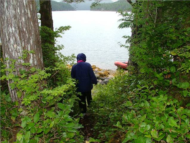
The plan for today was to continue south to Kisameet Bay just across from Fog Rocks in Fisher Channel, north of Burke Channel. Anderson Cove was successful in finding a water pump, believe it or not. One of his friends, the Captain of MV Dynasty, had an extra pump he was happy to help out with. Anderson Cove had seen Dynasty this morning as he was heading south and Dynasty was heading north. Sea Foam had not left Codville Lagoon yet and that was where Dynasty was heading so we offered to stay back and wait for Dynasty and we would deliver the pump to Anderson Cove later when we met in Kisameet Bay. While we waited for Dynasty to appear we did basic boat chores. I was preparing seafood lasagna for dinner tonight for Anderson Cove and Magistra. Dynasty arrived several hours later after being held up catching a halibut. Bill Lumley and his wife Bonnie met Rick. Bill wanted to change his existing water pump and give that to Anderson Cove and install the new pump he had for greater insurance as he still had another month of cruising to do. His engines were too hot now to give the pump to us so we made contact with Anderson Cove in Kisameet and it was decided that Rick and Warren would run up to Codville Lagoon from Kisameet tomorrow morning in the Catch-Up and pick up the spare pump at that time. The distance between the two anchorages was only about eight nautical miles. We weighted anchor and headed south to meet with Anderson Cove and Magistra in Kisameet Bay. The water in Fisher Channel was calm and the sky was blue. We saw a small pod of orcas heading north and one humpback heading south as we approached Fog Islands and the entrance to Kisameet Bay. The anchorage in Kisameet Bay is beautiful! We entered immediately south of the largest Kisameet Island as Don Douglass’ book suggested and anchored north of the easternmost Kisameet Island. As we entered in we could see the rock on our starboard side sticking out of the water but the one on the chart coming on our port side was not visible. We used caution motoring about in the Catch-Up while taking Kona to shore until we had several safe tracks to follow using our portable GPS/sounder. We arrived just in time for Happy Hour and dinner aboard the Sea Foam. We were invited to raft up with Anderson Cove and Magistra as it was a very sheltered anchorage with little worry of winds blowing up and causing trouble during the night. The view out to Fisher Channel from our anchorage was lovely. After supper, when Carol was climbing back onto Anderson Cove’s stern cockpit, she heard and spotted a humpback whale coming into the anchorage. We had to take Kona to shore anyway so we hopped into the Catch-Up and went out to see if we could have a look at the whale. As we headed towards the exit of the anchorage there was not only one humpback but two. They were having a leisurely time meandering about Fog Islands and the shore line of the large Kisameet Island. Several times one or the other of them waved their large white pectoral fin into the air. We just can’t get enough of watching these huge creatures so gently and slowly moving around in the water! The sound of their blowhole and the height of the mist that shoots up is amazing. It was a bit rocky in the boat and the light was leaving us so we decided to leave picture taking for another day. |

|
Date |
|
(Chart) |
Weather |
|
Aug. 3/06 |
|
Kisameet Bay, King Island |
Sunny with a few cloudy periods |
Click on
Pictures to Enlarge
|
Marking Our Way to
Roaring Stream from
Our First Glimpse of the Lake
from the Trail
We’re in the Right Place!
Kisameet Lake on a Dull Day
Happy Hour Onboard the Magistra Left to Right: CA, Carol, Bruce, Al, Lois, Kay,
Warren, Rick and Alec not shown
Small Boats Launched in Bella
Bella, Shearwater or Bella Coola Travel These Waters Too |
Early rising today as Rick and Warren had to make the quick run eight nautical miles up Fisher Channel to pick up the water pump in Codville Cove from Bill on the Dynasty. It is reassuring to witness the level of support and assistance you can count on amongst the cruising boats in this remote area. While Rick and Warren were away I had an opportunity at last to have fishing lessons with Al Barnes. Al got the Anderson Cove’s tender ready and we set out for the entrance to the anchorage to do some cod jigging. Al had caught a small ling cod here yesterday afternoon and thought we should go back for some more. We fished for about an hour and we managed to catch two small kelp greenlings and a rock cod. We saw through the islands that Rick and Warren were fast approaching in the Catch-Up so we returned to the Anderson Cove to show off our morning’s catch. After lunch Rick and I headed out in search of the trail leading to Kisameet Lake. We took along a roll of surveyors’ tape to mark our way as we hiked through the bush. Rick had scouted out the entrance earlier in the day when he took Kona to shore. We secured the Catch-Up and again, the tide was going to be rising so it would be easy to leave the boat for an hour or two. We started into the trail and found it quite easy to follow with the exception of a few spots where we had to meander left and right to find our way again. The trail was there but the underbrush and knee high shrubs made it difficult to follow at times. What was our constant guide was the wide, fast flowing stream ever constant on our left side. We made it to the lake after one major problem finding the trail. We almost gave it up but with some extra tenacity from CA we found our way and were very glad we did. The lake was lovely and much larger than we expected. We were able to get right down to the shore line and enjoy the view. Another good swimming hole on a hot day! We made sure to mark the trail well as we went in and on our return back out. We want to be able to come back to this spot next year! When we returned to the Catch-Up we noticed that the MV Hideaway was anchored near us. Captain Bruce was the man who came onboard the Sea Foam in Fly Basin and helped us bleed our fuel lines when the Sea Foam was struggling to start up. We met his wife Lois for the first time and were happy to hear they were coming to Happy Hour onboard the Magistra and after supper invited us back to their vessel for dessert. We enjoyed pleasant conversation and more interesting facts and folklore about the anchorages we have visited and have yet to see. Bruce and Lois have been boating in these waters for thirty five years and have many interesting stories to tell. Bruce used to work for BC Packers and is very familiar with the waters around these parts. One such story was that Kisameet Lake is a sockeye salmon lake and the First Nations people use the trail to go to the lake to count the fish. There is also rumour that the “muck” is very beneficial as a facial mask and should be slathered on thick to your face for a clear and revitalized complexion. Lois told us that last year she and two of her girlfriends had their picture taken with mud smeared all over their three faces. During dessert Bruce showed us pictures from last year of his boat on the rocks in Goldstream Harbour at the northeast tip of Hecate Island off Hakai Pass. He was rafted to another boat in eighty feet of water and during the night the wind shifted and picked up. He dragged anchor and at 0100 was woken up by his rafted neighbor and informed they were on a rock and the tide was dropping. Bruce and Lois had to watch for five hours as their boat sat up on the rocks leaning well over on the port side, almost to the cap rails. In that time they managed to cut the lines between the two boats; they were too tight now to undo by hand. They plugged all the scuppers with beach towels so no water could get onto the deck and into the engine room. They isolated each fuel tank to eliminate the possibility of any tank on the high side draining to the low side. All tanks onboard were considered for this. They took pencils wrapped in face cloths and stuffed them into the fuel vents so water wouldn’t find its way in there either. What was running through my head while he was explaining all this was – ‘these people are experienced boaters!’ You just never know what might come up and you must always be due diligent – there is no room for complacency. One minute you can be basking in the sunshine in a calm anchorage chatting with your friends and the next minute you are awake in the middle on the night in pitch blackness to find you are in a situation that requires quick thinking and a clear head. I asked him about any damage their vessel sustained during the ordeal and he said the only damage was to his ego! He added that when he showed the photos to his insurance company they were very pleased to know that everything had worked out. He went on to say that an old wooden boat like his would not likely recover from the damage if water had found its way in and sunk his port side under the water line. We enjoyed many sea stories, dessert and a variety of liquor choices aboard the Hideaway and retired to the Sea Foam after another eventful day. |


|
Date |
|
Weather |
|
|
Aug.4/06 |
|
Kisameet Bay, King Island to Rock Inlet, Namu Harbour |
Beautifully Sunny!!! |
Click on
Pictures to Enlarge
|
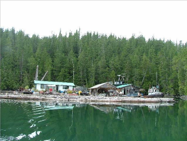
Peter the Caretaker Working At Watching the Incinerator
Rene and CA Talking Over
Horticulture
Namu Bunkhouse to Stay Red Roofed Dwellings in the
Background To Be Demolished
Boardwalk Travel At Your Own Risk
Private Sale of Home for Summer Fishing Retreat
Joe’s Cove Fishing Lodge Girls
Rick and Kona Waiting For a Meal In Namu’s Outdoor Cook Shack
Caretaker’s Quarters
Looking Out Across Whirlwind Bay
From
My Two Prize Ling Cods |
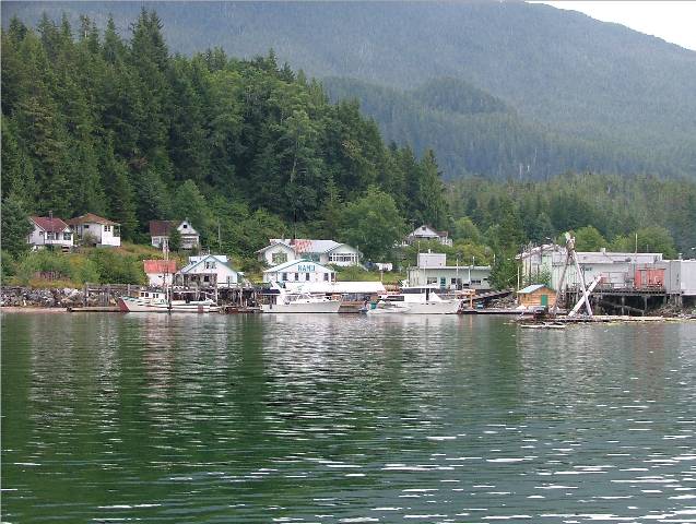
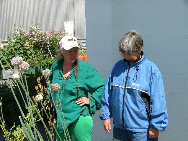
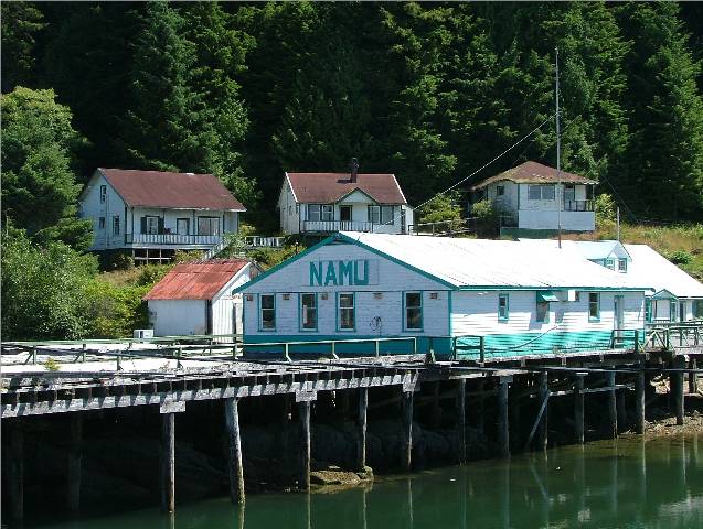
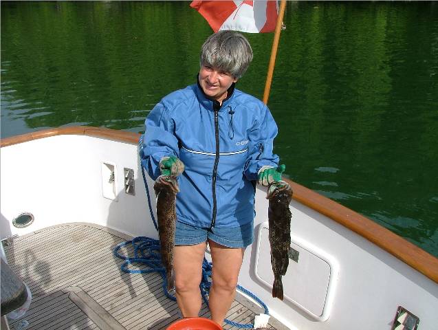
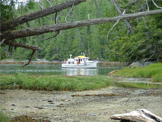
The Captains from the Sea Foam and the Anderson Cove had a meeting on the rocks during Kona and Miss Muggins’ shore duty about plans for the day’s travel. Anderson Cove was heading for Fougner Bay at the beginning of Burke Channel just north of Namu. Sea Foam would be heading for Namu to check out the old cannery site. After breakfast we untied the Sea Foam from the “raft” and headed out. Fitz Hugh Sound was calm and the short ride down to Namu was lovely. We drove slowly by the Namu dock and on into Rock Inlet to anchor. Once inside and anchored we put a crab trap down and took the Catch-Up out to explore Namu. We were greeted by a friend of the caretakers’ and their dog, Lady. We tied up and looked around. There was a substantial outdoor barbeque area for pig roasts and other feasting. Water was available at the dock beside the fish cleaning station. We checked it out and it appeared to be less brown than the water in Shearwater, although it was also ground water from the large Namu Lake behind the settlement. There were showers, laundry facilities, a small gift shop and a machine shop for minor repairs to boats that come and go from the Harbour. As we walked up from the dock we were met by the caretaker, Rene, while her husband Peter, closely watched the incinerator while burning paper trash. She cautioned us about the state of ruin around most of the area. She suggested we walk twenty feet apart if we wanted to be on the boardwalks. That way, she added, the person walking behind would be close enough to pull the other one out when you fall through! We determined that we would only walk on cement or ground, nothing made of wood. She went on to say we could walk to Namu Lake but we would have to go along the bear trail and take our chances if the bears were interested in entertaining visitors today or not. Rene told us that an architectural firm had been hired to determine the state of the buildings there and almost all had to be destroyed. When I inquired how old these buildings were Rene said one of the buildings is pictured in a photograph from 1920. They are apparently rotting from the inside out. The only buildings that will remain are the ones painted white with turquoise trim. These buildings have tin roofs and are in better repair. One of them has been sold to a private individual for their use while fishing and to accommodate guests for several nights. The other two building serve as bunk house and additional private accommodation for guests arriving in Namu to fish in the area. Rene said that many of their customers come from the interior with smaller boats that they have trailered there and launched into the water from Bella Coola. They then travel by boat down through Burke Channel, a short distance in Fisher Sound and on into Namu to fish. They don’t typically have adequate sleeping and cooking facilities on these boats so they are put up in the accommodations there and Rene prepares meals for them. They have pig roasts once a month in the outdoor barbeque area. When we asked her about the winter storms that must kick up in Whirlwind Bay she agreed that they are quite substantial. She said that they move their float home into Rock Bay Inlet for the winter and secure anything else to the docks. They have converted a space in one of the buildings from the cannery days into a small apartment for themselves for the winter months. She said that during a winter storm you don’t even want to go outside for the bits of wood and tin that might be flying around that could clunk you on the head. We asked her how the fishing was going around here and she said it was dismal. Someone from Joe’s Fishing Lodge at Hakai Pass had caught a sixty pound fish yesterday in “The Gap”, but we don’t know where that is. When we asked we were told it was somewhere between Hakai Pass and Japan. Fishermen are very secretive folks! She said the word on the street was the run was coming and should be arriving any day. We asked about the wildlife in the area and she said there are grizzly bears, wolves and deer. She said last winter she had two large dogs, both over one hundred pounds. They were outside one morning as usual and then not seen again. She said they were likely lured away by wolves and eaten, much like the story from Calvert Island we had heard earlier in our trip. As we walked around she showed us her flower and vegetable gardens. She said she keeps the seeds from the plants that have acclimatized themselves to the area and uses them the following year to plant. She pointed out some of her tomato plants that were covered with soot from the generator exhaust coming from the building they were leaning against. She said the exhaust pipe had broken and black carbon had spewed out all over her tomatoes. Within the next two weeks these plants grew another foot and a half. She thought they appreciated the extra blast of carbon dioxide even though it didn’t look too appealing to have black soot all over the leaves. As we walked through the “cement” part of the town site we met two young women who work at Joe’s Fishing Lodge on Nalua Island. They were off for the day for a scenic tour of Namu and had brought two other young people with them who were vacationing at the lodge. They had walked to the lake and had not seen any bears. They confirmed that fishing was poor but someone from their lodge had caught a big one yesterday! They were the ones who had brought this news to Namu that Rene had told us earlier. After our tour of the town we went back to the Sea Foam and geared up to go cod jigging. Now that I had my lessons I wanted to practice my skills. I decided that cod would like to live on the northeast side of Cliff Island. We were able to get very close to the shoreline here, out of the wind, and still have a depth between sixty and eighty feet. We caught three rock cod, two greenlings and my prize – my first two ling cod! We turned back about ten other small greenling and rock cod. I think fishing is like gambling for me – I just want to try one more time! We returned to the Sea Foam and collected four rock crabs from our trap. With Rick watching over me, I filleted our fish off the swim grid where the mess is easy to clean up. After dinner I had to call Al from the Anderson Cove on the VHF and report that his fishing lessons had paid off. We ate barbequed ling cod in Ginger Thai sauce with nary a bone in site and it was yummy!
|

|
Date |
|
Weather |
|
|
Aug.5/06 |
|
Rock Inlet, Namu Harbour to Sea Otter Inlet South Cove, Hunter Island |
Sunny |
Click on
Pictures to Enlarge
|
View From Sea Otter Inlet Looking Across Fitz Hugh Sound At Burke Channel and Namu
Tight Squeeze to Target Bay on the Other Side of Sea Otter
Inlet From South Cove
Shore Duty At Entrance to
Humpback in Fitz Hugh Sound As Seen From Cut At Sea Otter Inlet South Cove
Looking From Cut Into Sea Otter Inlet South Cove
Sailing Vessel from Anchored Near Us In Sea Otter Inlet South Cove |
We talked with Anderson Cove and Magistra on the VHF this morning. Anderson Cove were on their way to Rock Inlet where we were in the hopes of catching some crab. We informed them that we had only been successful in catching rock crab, not Dungeness, which is their preferred species. Magistra was staying in Fougner Bay one more night because they found it so delightful there. They met with Jim from the MV Nirvana and were enjoying their company. As we were preparing to hoist our anchor Anderson Cove came in. Rick went over in the Catch-Up with Kona and told them we were headed for Sea Otter Inlet, on Hunter Island just across Fitz Hugh Sound as the salmon swims. We said good-bye to the Anderson Cove and told them we would keep in touch by radio. We crossed Fitz Hugh and the water was calm and the sky was blue. We spotted two humpback whales along our path and slowed down to take some pictures of them. They are tricky to get a good shot of! We found our anchorage with little difficulty and noticed that two other sailing vessels had found it too. The small inlet is deep in the middle with a few spots along the edges that are about fifty to sixty feet deep. They were anchored where we wanted to be but we decided to anchor just across from the opening that looks out to Fitz Hugh Sound. We took Kona to shore and explored the immediate area. We wanted to take the kayaks through the small opening that leads over to Target Bay and Mustang Bay off Nalau Island. It was a short route rather than going quite a distance further around the outside of the island. Unfortunately, the water was too low and the tide would not be higher until some time after supper. We decided to go fishing instead. I have cod fish fever! We got our gear and headed out to Hanna Islet, just outside the entrance to our anchorage. We caught upwards to twelve rock cod and greenlings but released them all. I was after a big ling cod; none of this small potatoes stuff! While Rick was releasing a small rock cod with the aid of our pliers to get the hook out of its mouth, the little fish flicked its tail and the sharp spikes on his back hit Rick in the hand. The pliers fell in the “drink” and we called it a day. Quit while you’re ahead. After supper we took the Catch-Up through the opening to Target Bay. With the motor up we managed to slowly squeeze through the opening. We hit the bottom at one point but we pushed ourselves off with one of the oars and away we went. With the motor up it still propels us through and the first thing to hit is the aluminum bottom. We went through slowly enough that it was just a little bump when we touched the bottom. It was hard to judge the depth because of the brown rock seaweed on that part of the bottom. We knew that by the time we got back from our exploration this waterway would be deeper with the rising tide. We checked out Target Bay and Mustang Bay off Nalau Pass and took more pictures. Kona had a short visit to shore and we returned through the narrow opening without incident. We further explored the head of the bay and realized that we could have anchored deep inside with plenty of depth. We thought the sailboat anchored there had gone to the farthest part of the bay before it became too shallow but, in fact, we could have fit between him and the shoreline easily. After supper a large “Monk” arrived in the anchorage to join the three of us already there. It was an old boat that you might expect Frank Sinatra to have traveled in during his day. The white haired crew onboard probably would have been some of Frank’s admirers. The wind picked up and the lapping on the hull began. Several gusts of wind sounded off our burgee and signal flags. We were happy to be safely snug in our anchorage rather that out in Queen Charlotte Sound where it appeared the wind was coming from.
|
|
Date |
|
Weather |
|
|
Aug.06/06 |
|
Sea Otter Inlet, Hunter Island to Narrows Cove, Fish Egg Inlet |
Cloudy |
Click on
Pictures to Enlarge
|
Shore Duty at Narrows Cove |
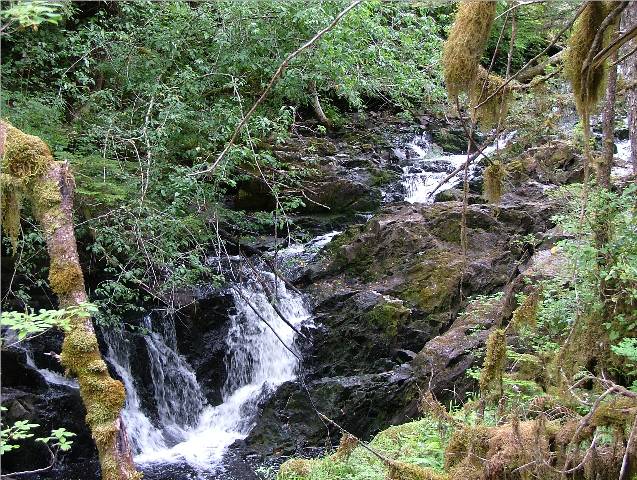
By 0830 we were getting ready to depart. After shore duty for Kona and a few more pictures we hoisted our anchor and headed out into Fitz Hugh Sound. The sea was calm with maybe a one foot chop. We heard Alec from the Magistra on the VHF with plans to go fishing for coho and halibut with Jim from the Nirvana. They will meet Anderson Cove in Goldstream in the next few days. Alec will likely anchor in Rock Inlet for tonight. We hailed Anderson Cove and they are headed for Kwakume Inlet to anchor for the night and fish off Koeye River as they proceed southward to their intended anchorage. We crossed back over to the mainland side of Fitz Hugh Sound and traveled close to shore through Fairmile Passage past Green Island Anchorage and on into Fish Egg Inlet. Both the Waggoner and the Douglass’ guide books indicate that, although this area was charted in 1991, there are still hazards that are uncharted. We decided to anchor off the “Narrows” in a cove that the Douglass’ call Narrow Cove. It is a mile and a bit past Gildersleeve Bay. They have also indicated another small area in this cove for small boats called the “Gee Whiz Nook”. We anchored in sixty feet of water and took the Catch-Up out to explore. Both guide books mentioned “uncharted” rocks that are found in this inlet and recommend a bow watch when coming into most of the anchorages. I think the folks who did the charting in 1991 should be asked to come back and do it again – this time with more detail. Rick thinks that all things necessary are charted and there is no need for concern. The uncharted rocks that we have been alerted to in the guide books usually occur just off the “green” areas of islands or large rocks where most boats shouldn’t be traveling so close to anyway. Any rocks in the middle of no where away from shore or islets are marked as such. It definitely gives you a feeling of tension to be putting along in your tender and finding a rock three feet below you when your sounder alarms. Just looking over the side and seeing the “alligator” below that could make a nasty gash into your mother ship’s hull leaves you on high alert when traveling in close quarters. It also makes you very hopeful that the chart does indicate “all” the rocks in the deeper more open water. We putted around the anchorage and then out into the narrows and headed toward Waterfall Inlet to drop a prawn trap in a hole we spotted at 107 metres. We dropped the trap and went back to our anchorage and noticed a float home in the Waterfall Inlet area that we would check out tomorrow. We got back and put out a crab trap with some of the remains of our recent successful cod fishing trip. The sun had come out so we enjoyed a pleasant evening of warmth and excellent scenery. So far today, once we entered Fish Egg Inlet, we have not seen another boat in the vicinity. We relaxed, had supper and retired. |
|
Date |
|
Weather |
|
|
Aug.7/06 |
|
Narrows Cove, Fish Egg Inlet to Waterfall Inlet, Fish Trap Bay, Oyster Bay and finally Joe’s Bay |
Cloudy with on and off Rainy periods |
Click on
Pictures to Enlarge
|
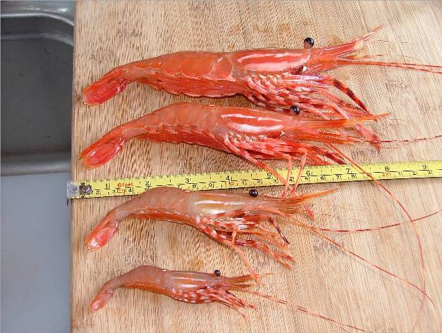
Small, Medium, Large and Extra
Large In the Four Years I’ve been
Prawning I Have Never Seen a Prawn as
Large As This Extra Large! Nine Inches from Tail to
Spike-Like Nose!
Remotesville Anchorage Waterfall Inlet
Pack Rat Camp in Waterfall Inlet
Waterfall Directly North Of Pack Rat Camp Good Fresh Water Supply No Doubt
Anchorage at West Side of
Waterfall Inlet At Head of the Bay
View Looking South From Waterfall Inlet
Alien Easter Egg Reflected in Calm Water in
Waterfall Inlet
Where There’s a Will There’s We NamedThis “Lone Tree Islet”
The Only Vessel We Saw in Fish
Egg Inlet Anchored in One Stick Blends Into Another
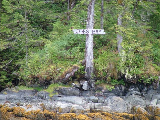
We Wonder Who Joe Is??!!
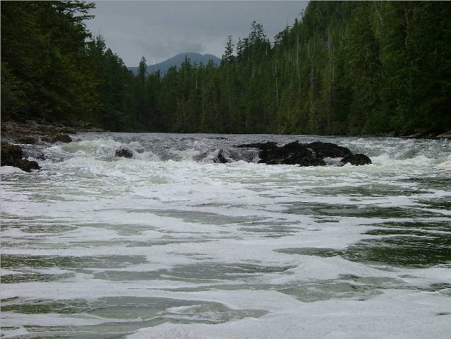
Rapids to Beat For Entry into Elizabeth Lagoon
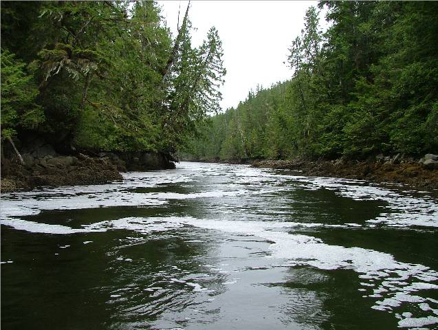
Foam on the Water From Rapids Back to Joe’s Bay Anchorage |
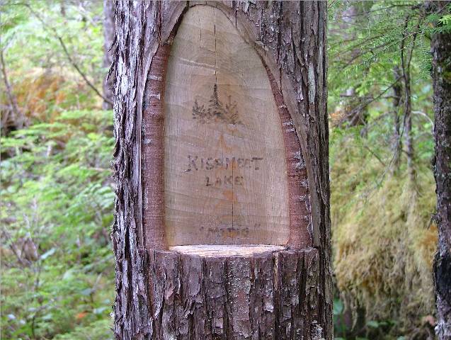
Woke up to rain and a weather forecast calling for gale force winds from the southeast. We were in a good spot for a gale, well tucked up in an inlet with little chance for wind to pick up the water and make big waves for us. Our crab trap yielded only four very small dunganess crabs that had to be turned back and two very large starfish. After breakfast we pulled up the anchor and headed for Waterfall inlet. On route we pulled up beside our prawn trap that we put down yesterday. Rick left the Sea Foam in the Catch-Up while I waited behind with the engine off and drifting. He pulled the trap up and reported by radio that we had caught only four prawns. Once back onboard we headed for Waterfall Inlet and an anchorage there that the Douglass call Remotesville Cove. It may have been blowing gale force out and around Queen Charlotte Sound and Fitz Hugh but in Fish Egg Inlet and surrounding area it was flat calm! Once we were anchored we headed off in the Catch-Up to explore the northern part of Waterfall Inlet. As we proceed north we spotted a float home assembly on the east side of the inlet. As we approached we saw a man out on the dock but when he saw us he quickly retreated into his trailer and made it quite clear that he did not wish to entertain an afternoon visit. We moved away from his “home” and went around the back of his “yard” to take a few pictures of the waterfall nearby. It was a small one but pretty none the less. We moved on up the inlet into an anchorage in the northwest corner of the inlet. We took several pictures there while Kona had a sniff around and proceeded back to Remotesville Anchorage. Once there we pulled up our anchor and headed for Oyster Bay and Fish Trap Bay. When we motored past Fish Trap Bay we noticed that the gales predicted for today were making their way into this area. The wind was rolling in over the mountain tops and gusting around the waterway. As we turned into Oyster Bay we were hoping to see the reflection of a “face” coming off the point of one of the rocks as suggested in the Douglass’ book. Unfortunately, with the gusting wind and the light chop the water was not able to reflect the face we were hoping for. We moved into Oyster Bay and were surprised to see our first boat. A sailing vessel was anchored in front of the small island at the head of the bay and the “williwaw” wind that was sweeping through the inlet was tossing their bow back and worth. As we maneuvered in the tight area to turn around the wind caught us on the side and it made the quick turn we needed very difficult to execute. Captain Rick handled the situation and we were soon turned around and headed back out again. We did not want to anchor in this inlet tonight! We headed back along the same track we came in on using our handy dandy GPS Sounder/Plotter. It is reassuring to know that you can follow the little red line back over the same way you’ve already been. It cuts down on the likelihood of running into any uncharted rocks. We decided to aim for Joe’s Bay at the head of the inlet west of Waterfall Inlet. There is a huge lake behind the bay called Elizabeth Lagoon. The only way to get to it is through a narrow channel that is full of rocks and only navigable during high water. The high tides for today were occurring at midnight or thereabouts so it was a guarantee that we would not be trying to get into the lagoon. Once anchored in Joe’s Bay we got in the Catch-Up and went to see the rapids. The narrow “bowling alley” leading up to the overfalls was about twelve feet deep. It was hard to determine if our sounder was accurate with all the foam and bubbles that the rapids were creating. We got as close as we dared and took some pictures. The tide was high but not a “high high” so again, there was no way we were going to be able to make the lagoon. We had read in the Waggoner about a couple with their two sons and a dog who had gone into the lagoon successfully but had a wild ride getting back. They ended up off loading all the passengers except their son who, after a few hits on the rocks with the propeller, managed to get the dinghy safely back on the otherside of the rapids. The other passengers, including the dog, had to walk through the bush and negotiate the rocks on the west side to get to safety. I was, to say least, quite happy to find that we would not be attempting the rapids with the present tides. When we first anchoraged the gales in the Queen Charlotte Strait were being felt even in this secluded and protected bay. Gust of wind came over the tops of the mountains surrounding us and sent shivers of movement over the water. Because we were so protected the wind had little effect on the water but rang around in our ears none the less. By the time we had supper and were ready for sleep the wind had calmed and the anchorage was now calm and peaceful. All that we heard were ducks and two seals slapping around in the water. A good night in Joe’s Bay.
|

|
Date |
|
Weather |
|
|
Aug.8/06 |
|
Joe’s Bay, Gildersleeve Bay, Man-Trap Inlet, Fish Egg Inlet and finally Fury Cove, Fury Island. |
Rainy in the early morning, cloudy and sunny after supper. |
Click on
Pictures to Enlarge
|
Float Home in Fish Egg Inlet
Wayne, Emi, Gracy, CA in
Max Added to the Photo
Narrow Gap into Large Lagoon At Head of Mantrap Inlet South |
We woke up to a low tide and a different look to the rapids and the foam they created all over the anchorage. We wanted to spend the day exploring the rest of Fish Egg Inlet while the weather was still stirred up outside in the open. After shore duty and more pictures we pulled up the anchor and headed for Gildersleeve Bay. We noticed a small float home and two small runabouts fishing across from where we anchored. We would only be about two hours exploring the area so we put the Sea Foam in a safe spot and headed out in the Catch-Up. We decided to do some fishing thinking that there might be some fish in the neighborhood. We trolled along for a while along the shoreline and then decided to go back to my favorite thing – cod jigging! Once again I was successful at every drop of the hook in catching a cod. Too bad they were all rock cod and greenlings, which, although the meat is good, aren’t worth the trouble to clean for the bones and little meat you finish up with. We did keep a black bass and a something-er-other that looked almost like a trout. I wanted to go exploring in Mantrap Inlet so we put away our fishing gear and motored slowly past the float home we had seen nearby. A man came out to greet us and after about five minutes of conversation he invited us into his home for coffee and to meet his wife. Wayne, and his wife, Emi, (em-ee) have lived in this float home for six years. Wayne has a small lumber mill in his “backyard” and several boats that he used to tow logs and beach comb. Their home was very quaint and cozy and their two dogs, Max and Gracy, and their very big cat, Bear, thought so too. Wayne and Emi are also friends with Rene and Peter from Namu and the boom of logs that we saw in Rock Inlet when we were anchored there belong to Wayne. He is making the lumber that is being used to construct a resort at Goose Bay, River’s Inlet that is owned by several Burnaby Firemen. They told us about the wildlife in their “neighborhood”. Emi is an animal lover and this morning was very annoyed that an eagle made off with one of the ducklings that were nesting nearby. She said there are a team of grizzlies that go by their home once every three to four days. There is a sow and her cub and a big male. Sometimes, to get around behind their float home an away from the human element the bears swim along the perimeter of their house to get to the other side of the bay. Wayne is very knowledgeable about the fishing in the area and he was telling us he recently took out a group of fishermen and their young sons for several days. They had a successful trip and caught not only salmon but several large halibut as well. Two of the halibut were over one hundred pounds. He said the only way to get them into the boat without getting thrown around by them is to shot them in the head with a twenty-two. He added if you don’t make your mark the huge fish will swim straight back down to the bottom again and the struggle begins all over. Emi said that in the winter she is often alone while Wayne is out beachcombing and looking around for logs that have come down in a rock slide or been lost from booms during a stormy sea. She said when she first moved up to the inlet she was afraid of the “unknown” not having lived in this remote an area before. Now that she has six years under her belt she loves the life. She says she feels safer here than she did walking around in the West End of Vancouver where she used to live. One morning last winter when she was out on the deck shoveling a path in two feet of snow a large shadow from above caught her attention. Their pint sized dog, Max, was digging in the snow nearby and a hungry eagle had spotted him. He was on the way down with his talons leading the way, to scoop Max up for lunch. Emi said she waved her shovel in the air and shouted but the eagle continued to hover just above them both until Gracy, their big dog, came flying around the corner with much growling and barking and scared the large bird away. We spent about an hour visiting with Wayne and Emi and when we left I was showing Wayne some of the tackle in our fishing box and asking him what he recommended we use to catch a salmon. He had caught a twenty pound Coho that morning off Addenbroke Island and it was laying on the deck waiting for him to clean. He admired a spoon we had in the tackle box and I gave it to him. In return he correctly rigged up one of our flashers and sliced off and filleted one half of the salmon he had just caught and handed to me. Now, that’s what I call hospitality! We said our goodbyes with a promise to return next year for another visit and headed off for Mantrap Inlet. As you can see from the chart it is an area that is not recommended for big boats to anchor in but a small tender would have no problem getting in. The name fits the bay because if you go in to anchor and try to get out when the tide recedes you are trapped inside until the water rises up again. We were at high tide but it had just begun to fall so we headed into the narrow opening and on up into the narrow entrance to another lagoon. There are two lagoons at the end of this inlet. Once is quite easy to access and apparently smaller boats can anchor in there. The author of the Waggoner has taken his twenty seven foot Tolly in there with little difficulty. We eased our way slowly up to the larger of the two lagoons. As we motored up the current was against us and the entrance narrowed with rocks jutting out from both sides. The water appeared to be deep enough but we didn’t want to take any chances coming back out again with the water level lowering and the current picking up further and pushing us out with little control. It’s always easier to go into the current for steerage but when you’re pushed from behind things can get a little hairy. We took several pictures and made our way carefully back the way we came and returned to the Sea Foam. When we were again underway we radioed the Magistra to see if they were anchored in Fury Cove at Penrose Island. We were surprised to hear that Anderson Cove was also in Fury Cove and there was plenty of room in the popular anchorage for us. We moved out of Fish Egg Inlet and again into Fitz Hugh Sound. The water had been duck pond calm earlier in the afternoon as we later found out from Magistra but for us the wind had picked up, as it often does in the late afternoon, and the chop from the west was about three feet. It was just a short distance from where we were so we didn’t worry about it too much and there were no swells as we were behind Calvert Island. When we pulled into the anchorage at Fury Cove there were seven other boats in there. It isn’t hard to understand why it is so popular. There is a beautiful sandy beach at the west side of the anchorage that looks out over Fitz Hugh Sound. On the other side of the beach, where the water from the Sound pounds in, there is more white beach. There is plenty of room, good depths, and good holding. The sun sets over the anchorage and the view of the sky at night is stunning. We were invited to a late happy hour on the Anderson Cove to catch up on everyone’s news from over the last three days. Magistra had been in Namu catching salmon and halibut with friends aboard the MV Nirvana and Anderson Cove had caught two salmon and one ling cod in Hakai Pass area. They were catching fish but not in the quantities they were used to in previous years. We returned to the Sea Foam and picked up Kona for shore duty. The sun had come out and the sky was blue and the air was fresh. We had dinner, caught up on the log and watched a beautiful full moon appear over the anchorage. Another glorious day concluded on the water! |
|
Date |
|
(Chart) |
Weather |
|
Aug.9/06 |
|
Fury Cove, Penrose Island |
Sunny and warm. |
Click on
Pictures to Enlarge
|
Fury Cove Beach Inside
Fury Cove Beach on the Outside
View from Fury Cove Out to
Lunch Stop in Big
Returning Home to Fury Cove Looking out to
An Interesting Find Along the Way
We Always Travel With a GPS, Paper Charts of the Area And Walkie Talkies
Returning Home to Our in Fury Cove |
By the time we woke up everyone had left except Anderson Cove and Magistra. This is a popular take off point to go around Cape Caution. The trip isn’t that long and you can look out from the anchorage and see what the current sea conditions are and if you want to make a run for it or not. Anderson Cove and Magistra were soon on their way heading for Smith Sound to anchor in Milbrooke Cove. Their plans are to continue to look for fish for two more night in Smith Sound and then catch up with us later either in Port Hardy or in the Broughtons. We were all alone in the anchorage during breakfast but then two forty foot bayliners motored in. We got the kayaks down from the roof of the pilot house and packed a picnic lunch, complete with red wine, and headed off to explore Penrose Island. We had a chart, GPS and walkie-talkies. We were good to go! As we were getting into our kayaks the bayliner folks were pulling up anchor. As they slowly moved away they said they had just stopped in for breakfast after crossing Cape Caution from the south and were on their way north to Pruth Bay in Calvert Island. The weather and tide were perfect for us to paddle and we thoroughly enjoyed the scenery. We decided to paddle as far as Small Frypan Bay and climb out and have lunch there. While munching we saw only three small runabouts in the area out trying to catch some fish. There was a large helicopter working on something in the treetops across the way but we couldn’t figure out what he was up to. At first we thought he was scooping up water but the line hanging from the helicopter looked like it had a hook on the end of it not a bucket. We decided it’s a heli-logging operation. We packed up lunch and headed back. The water was so calm that we considered taking off around Cape Caution when we got back to the Sea Foam. It would be a sunny cruise on the water and we would have light until ten. If we had the moon like last night it would be a lovely crossing. When you’re kayaking and down so low in the water it is a great way to see the sights and get to know the surrounding area. It’s relaxing to look over the side of the boat close to shore and see the starfish and jellyfish and any other matter of creature that might be down there. On the surface we saw only seals and eagles. Our original plan for this summer was to go no further than the top of Calvert Island at Hakai Pass. I wanted to spend several days exploring the areas around Penrose, Walbran and Ripon Islands. After kayaking around just a small section of this area today I know we will have to come back again and spend more time here. When we got back to our anchorage in Fury Cove there were three other boats anchored. Kona was happy to see us back. We left at 1030 and we returned at 1700. Once we took Kona to shore, put the kayaks back up on the roof we decided to settle down for the night and leave early tomorrow morning for Port Hardy and the trip around Cape Caution. The weather is predicted to be moderate tomorrow so we plan to get up early and make the crossing. After supper we hear a call go out to the Prince Rupert Coast Guard from a fishing lodge in the area requesting assistance because one of their boats was overdue. We started listening to the transmissions at 1900 between Prince Rupert Coast Guard and the fishing lodge. Then Comox Coast Guard took over because they could hear the radio transmission from the lost boat and no one else could. The lost boat was adrift and one of gas and didn’t know where they were. The rescue went on until 2230 when a fisheries boat found the two people on a beach where they had been instructed to build a fire. During the three and a half hours that it took to find them several of the small guide boats from the fishing lodge were out hunting. BC Ferries going by was instructed to blow their horn to see if the lost boat could hear it. Several pleasure craft and commercial vessels were calling in to the Coast Guard to indicate their position and whether or not they could hear the radio transmissions from the lost vessel and also to say that they were not able to see any sign of the lost runabout from their position. From all the boats looking and the boats in the area calling in to say they could or couldn’t hear the radio transmissions from the lost boat, it took three hours to narrow down the search but they found the boat and the two missing people and all was well again. It was again very reassuring to see first hand how everyone helps out when someone out on the water is in trouble. Even the helicopter that we had seen earlier today (it was in fact logging from Welsch Island behind Penrose) volunteered to go up and search but the Coast Guard in Comox declined that offer because the people were not in immediate danger. The Coast Guard was sending out one of their rescue boats that is equipped to find a missing boat based on the radio transmissions. Throughout the rescue the Coast Guard made contact with the two lost people and told them to turn their radio off to conserve the battery and gave a specific time when he would call on the radio again. Comox Coast Guard also told the lost boat to shot off a flare and when that was unsuccessful he instructed them to light a fire on the beach that they had rowed over to. They were found in Edith Cove, which is one of the beaches that Rick and I and Kona had enjoyed just around the corner from Margaret Bay in Smith Inlet. A very exciting evening! Now to sleep for early wake up and our return south, around the “dreaded” Cape Caution.
|


|
Date |
|
Weather |
|
|
Aug.10/06 |
|
Fury Cove, Penrose Island to Millbrook Cove,Smith Inlet. Next to Leroy Bay then to Takush Harbour |
Sunny with cloudy periods |
Click on
Pictures to Enlarge
|
Sea Foam At
Trail Leading to
The Wind Whistling Through Smith
Sound
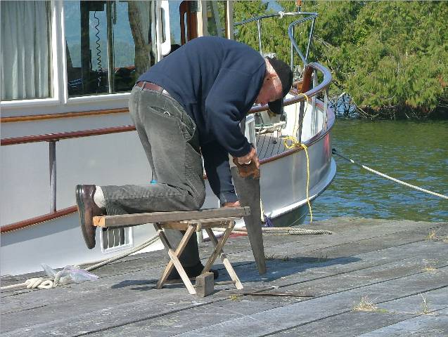
Captain Alec the Octogenarian Doing Boat Chores On Net Float Dock
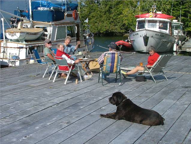
Happy Hour on the Net Floats |
We got up at 0545 and got ready to go with Kona to shore and all things secured for the trip. We listened to the weather forecast and things didn’t sound too bad. The wind at Pine Island and Egg Island were five and eight but West Sea Otter Buoy was blowing at eighteen knots from the northwest with a one point four metre swell. The rule of thumb was for West Sea Otter to be one metre or less but it was close enough so we decided to give it a try. Four other boats in the anchorage were doing the same thing and they pulled out about half an hour before we did. At 0630 we were out of the anchorage and heading south in Fitz Hugh Sound. So far so good with Calvert Island still on our starboard side. As we got going past Rivers Inlet the swells increased to two metres and they were quite steep. We were taking them on our beam so we corrected course a bit to help the ride and increased our speed. I tried lying down on the pilot house bench so at least I was rocking in the right direction along with the boat and not looking at the swells as they approached us. After about a half an hour more of the same I requested the Captain turn into Smith Sound and into Millbrook Cove to anchor. The trip around Cape Caution could wait until tomorrow. The Captain was not of the same mind but rather than have a mutiny on the vessel, he reluctantly steered his ship to safer harbour. As we pulled into Millbrook Cove the tide was a low low and slack. It is a very narrow rock lined entrance but at least we could easily see all the “alligators”. It didn’t look like a very nice place with the water almost drained out of it and an old derelict boat on its side along the shore line. We were pleasantly surprised though to see Anderson Cove and Magistra at anchor as we inched into the head of the bay. We talked with them on the radio and told them I had chickened out on the run for Port Hardy. They had spent yesterday picking huckleberries on the sides of the logging slash on the west side of the bay. They were making ready to head to Takush Harbour and try their luck at fishing again today. Rick had a second breakfast of coffee and toast and I collected my nerves again. I puttered around making lunch and dinner to clear the day for fishing of our own. The only two salmon we have caught this trip were from outside Takush Harbour. At 1130 we weighted anchor and headed out of Millbrook Cove. We contacted Anderson Cove by radio and they were on the fish net float dock and had their crab pots out and were out along Indian Island fishing. We went into Leroy Bay, across from Millbrook Cove, for lunch, a walk for Kona to Leroy Bay and a short siesta. The early morning aborted trip around Cape Caution had taken the wind out of our sails. We moved out of Leroy Bay as the wind was getting at us in there and met with Anderson Cove and Magistra at the fish net floats. Another boat from Bellingham, a Trophy, had come all this way to fish. They were planning on leaving for home tomorrow morning so they handed over their herring bait and gifted CA a ling cod lure. We enjoyed Happy Hour with everyone on the float in the sunshine, ate dinner and CA retired early. Captain Rick went out fishing by himself for a time but came back empty handed. Fishing was reported to be good in this area and we were going out early tomorrow to try and get a few for the freezer.
|

|
Date |
|
(Chart) |
Weather |
|
Aug. 11/06 |
|
Takush Harbour, Smith Inlet |
Cloudy in the morning, sunny afternoon and evening |
Click on
Pictures to Enlarge
|
From Left to Right: Anderson Cove, Sea Foam,
Magistra, Hideaway, Strike Two (not with us)
|
The Captain woke up at 0600 and said, “Let’s go fishing!” Seeing the fine catch on Anderson Cove’s vessel from yesterday had inspired him to try for salmon himself. We geared up, threw coffee and granola bars into the tender and out we went to the secret fishing spot. Our nifty sounder picked up the fish on sonar and we fished until 1300. However, we only caught a small spring (and I mean small) and a rock cod. We determined, after watching Anderson Cove’s crew pull out four more large coho, that we weren’t doing something right. As we were all fishing side by side we heard from Lois and Captain Bruce from the Hideaway hailing Anderson Cove wanting to know his location. When they heard we were all in Smith Inlet and catching fish (well, some of us were catching) they decided to come in for a visit and try fishing too. They had been in Philips Inlet, just up the way in Fitz Hugh Sound, a tricky, rocky infested but quiet anchorage, and said they were happy to have some company. They fished as they entered into Smith Inlet and they caught two nice fish as well. We all met up at the fish net float and after all the fish were cleaned we enjoyed Happy Hour together sitting outside on the floats. We were gifted a fine salmon, vacuumed packed and ready to go into the freezer. These are serious fishermen we have been keeping company with! They all felt sorry for us, I think, after looking at our sorry little catch. We pooled our resources and had a roast beef dinner complete with dessert aboard the Anderson Cove. A fine vessel that can seat ten people for dinner! Anderson Cove went out fishing again after supper and we laid crab traps in Fly Basin and retired. A fun filled and exhausting day! |

|
Date |
|
(Chart) |
Weather |
|
Aug. 12/06 |
|
Takush Harbour, Smith Inlet |
Cloudy morning, sunny all afternoon and evening |
Click on
Pictures to Enlarge
|
Cleaning Fish Operation Captain Warren and Assistant Al
Waiting to Be Cleaned In a Baby Bath |
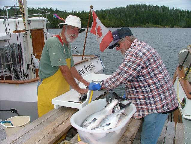
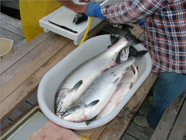
The water was mill pond flat this morning and we climbed into the Catch-Up to go fishing again. We had complete instructions, with demonstration (Al pretended he was the fish), last night during Happy Hour, so today we would catch fish. Catch-Up, Anderson Cove and Hideaway were all out fishing by 0830. News travels fast on the radio waves. That’s why fishermen often speak in code; they want to keep their successful fishing spots to themselves. There were two other boats in the area that must have heard us talking back and forth on the radio and they joined in as well. We circled and circled the “hot spots” and we caught ourselves an eighteen pound coho. Captain Rick is very faithful to his “technology” in the GPS/Sounder and insisted we put our down rigger deeper than the recommended depth. He was right and we had a nice fish. We continued fishing, got another one but it got away at the net. Anderson Cove caught another batch (after we told them what depth our sonar had the fish at) and so did Hideaway. Salmon for dinner tonight! We stopped fishing at 1300 and returned to the mother ship to clean our prize fish. Al and I went to Fly Basin to pick up our crab traps and we had a visit with Fisheries who had come into the basin in their zodiac. They are serious looking characters. Guns in holsters and the whole bit! One of the men who asked us all the questions was very polite and friendly. The other fellow kept a close eye on us without so much as a smile cracked. A young woman was in the wheelhouse but we had no interaction with her. Al had his license at the ready as well as his calipers to make certain his crabs were legal size before putting them into his bucket for dinner. I told them I didn’t have a license I was just the driver. Rick has the license for the traps so I didn’t pull ours up. Rick could do that later. Al had many female crabs in his trap but only one male. Being the conservative fisherman that he is he only took the male and returned the girls to their muddy bottom. We returned for Happy Hour and all nine of us sat on the floats outside again, enjoying the scenery and sunshine. It was breezy but with a warm sweater the outside seating was very pleasant. Lois cooked up one of her salmon and dished out large portions for everyone to enjoy aboard their boats for supper that night with enough for sandwiches for tomorrow. After supper Anderson Cove invited us onboard their vessel to have a hands on fishing demonstration. Kona was even invited along! We enjoyed a leisurely cruise out into the inlet and watched the fishing operation of the Anderson Cove. The night was beautiful but, unfortunately, the fish were not biting tonight. We returned to our boat and zipped out in the Catch-Up to retrieve our crab trap as well as Hideaway’s. We had one large male and Hideaway had seven! One of them was the biggest crab I have ever seen. Rick has never seen one that large either, even at a Crab-a-Rama! These were Dungeness too! By the time we got back after crabs and shore leave for Kona it was dark and the Hideaway was glad to see us back safely. They told us they were leaving for point’s north tomorrow morning and would be casting off by 0500. We thought that sounded like a good idea too so we went to the Sea Foam and got everything ready for an early departure tomorrow. |
|
Date |
|
Weather |
|
|
Aug.13/06 |
|
Takush Harbour, Smith Inlet to Port Hardy |
Light drizzle in the morning, cloudy early afternoon, sunny until night |
Click on
Pictures to Enlarge
|
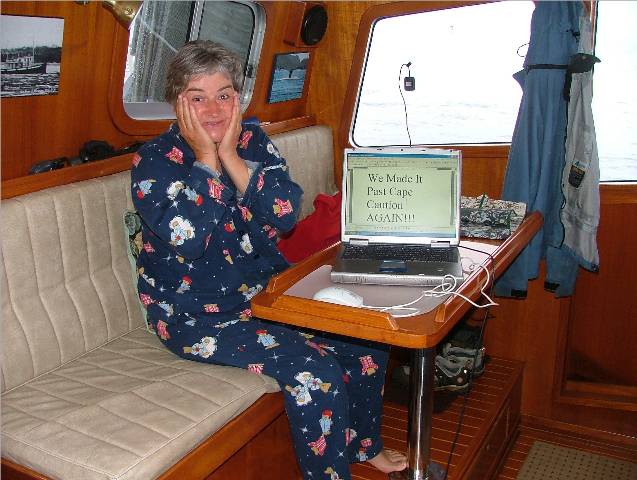
We Made It Passed Cape Caution Still In My Pajamas
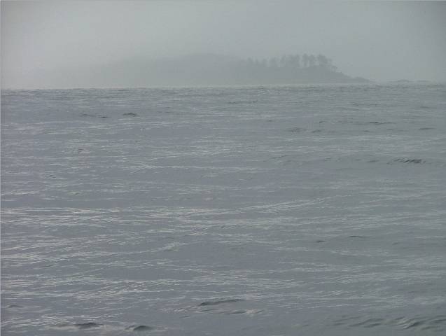
Storm Islands in
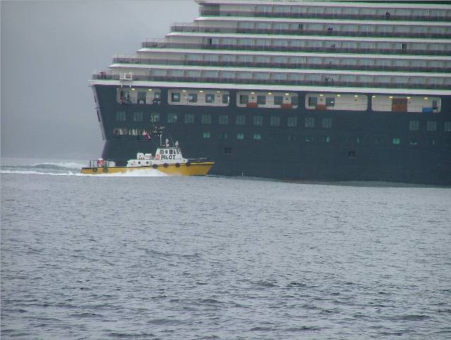
Cruise Ship With Pilot Boat
Approaching At Stern
Pilot Boat Getting Into Position
to Board
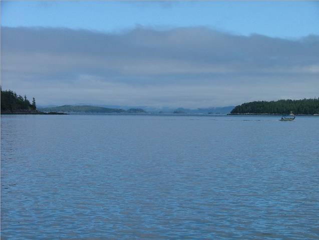
Calm Goletas Channel At 1130 A Lovely End to An Eventful
Crossing
Calm Morning For Fishing Off Duval Point at
Complicated Rigging From Fishing
Vessel In Port Hardy |
We woke up to the alarm at 0430, checked the weather report and decided it was a good time to head around Cape Caution. We left a note for Anderson Cove telling them of our quick change in plans and we would meet with them again in a few days near or around Port Hardy or the Broughtons. Anderson Cove has plans to take his boat out on the ways at Sointula on Malcolm Island and Al has his car there to return him to Victoria. The wharf manager watches over his car right by the office while he’s away and there is no charge for parking. Al will hop in and take the ferry from Sointula to Port McNeil and then down the island highway to home. Anderson Cove prefers to take his boat out of the water using ways because his boat is wooden. Apparently, there is less stress on a wooden boat sitting on ways than if it were hauled out by a harness which is typically what most boat yards use. They are okay for fiberglass hulls but not so good for wooden. Also, according to Anderson Cove, the personnel in Sointula are skilled at working with wooden boats. After scratching down a quick t note and sticking it to Anderson Cove’s cap rail we turned on our running lights, untied and were away by 0515. Hideaway called us on the radio as we moved out and said they were right behind us and were glad to have someone else along making the crossing. The visibility was okay, the fog was in the distance, and the swells were only about one metre. Bruce had mentioned last night that he wanted to leave when the current in Slingsby Channel was still flooding. If that area was ebbing and dumping its water into the main water body, Queen Charlotte Strait, it would cause more swell height and confusion in and around Cape Caution as the water from Slingsby would push against the water in Queen Charlotte Straight. To further complicate things the depth around Cape Caution is quite shallow as compared to the depth of the open sea so when the water comes rolling in it meets the sea floor and raises the swell height as well. Better to have the water moving in the same direction as the wind and your boat to make things as smooth as possible! It’s a tricky bit of business getting the timing right. The large inlets need to be flooding but, if they are, then Queen Charlotte Strait is too which means it is going opposite to your direction. It’s going north and you’re going south. It isn’t a big problem if there isn’t much wind, which fortunately, there wasn’t. It all reminds me of the thinking and planning you have to do when exiting or entering the Fraser River at Sand Heads or Point Grey. Large bodies of water meeting together have to be considered as well as the wind direction and speed that are affecting them. If all goes well, so does your cruise! We spoke to Hideaway several times during the crossing and we were happy and relaxed as soon as we got to Pine Island. We took a route on the west side of Storm Islands and they went on the east side between the islands and the mainland. They were headed for Port McNeil and we thought we would go into Clam Cove for breakfast and let Kona off before proceeding to Port Hardy. Several cruise ships and fishing boats were also out there in the early morning heading for their destinations. Some for pleasure, some for work! We were getting larger swells as we entered into Queen Charlotte Straight because the water was ebbing (heading northward) and the wind was blowing from the north pushing the water southward. Again, the two forces were opposite, water and wind, making the swells steeper and now about two metres high. The up side was that we had them on our stern so we only experienced them like we were surfing on top of them. The boats approaching us going out to sea were not as fortunate. They were beating into them bow first. After a quick pit stop in Clam Cove we headed into Browning Passage and on to Port Hardy. The ebbing current now was slack so we didn’t have any current against us going through Browning Pass and a flood tide beginning to push us the rest of the way to Port Hardy. The water was just a ripple as we headed south in Goletas Channel to Port Hardy. The sky was blue to the east but still socked in where we were headed. If the pattern continued, we were hoping the sun would come out by late afternoon. As we entered the inner harbour of Hardy Bay the commercial fishing vessels were all in and tied to the docks. The nearby private marina, the Quarterdeck, was also full for the night. Everyone is making their way south I guess. The fishing boats are getting ready to go to an opening and in position to take off. We managed to find a spot on the fishing dock near the processing plant. We had power but no water. We’re hoping tomorrow when the fishing vessels move out, we can relocate, get on the public dock with water and refill our tanks. Washing the boat might be in order too. We have to do laundry too - now that we are back in civilization we can’t be wearing clothes that have fish stuck to them or prawn parts! We took Kona to shore and then left her on the boat while we took the Catch-Up around to the other dock near the town. It is the first dock on the right as you enter the bay. The dock here is totally exposed to the wind and I’m not sure why anyone except fishing vessels would tie up there it is so rough. The wind really whistles through the bay in the afternoon and the chop is about three feet. Two sailboats were tied to mooring buoys there and they were rocking and rolling. Maybe on the days when the wind is calm it would work out but today was not one of those days. We tied up the Catch-Up at the dock and went to buy provisions. Once that was complete we headed back to the Sea Foam around the corner at the docks in the inner basin and off loaded our groceries. We had a quick dinner and prepared to sign off for the night. Getting up at 0430 and going around Cape Caution had pooped us out! |